Current time (in UTC/GMT/Zulu):
JavaScript Must Be Enabled.

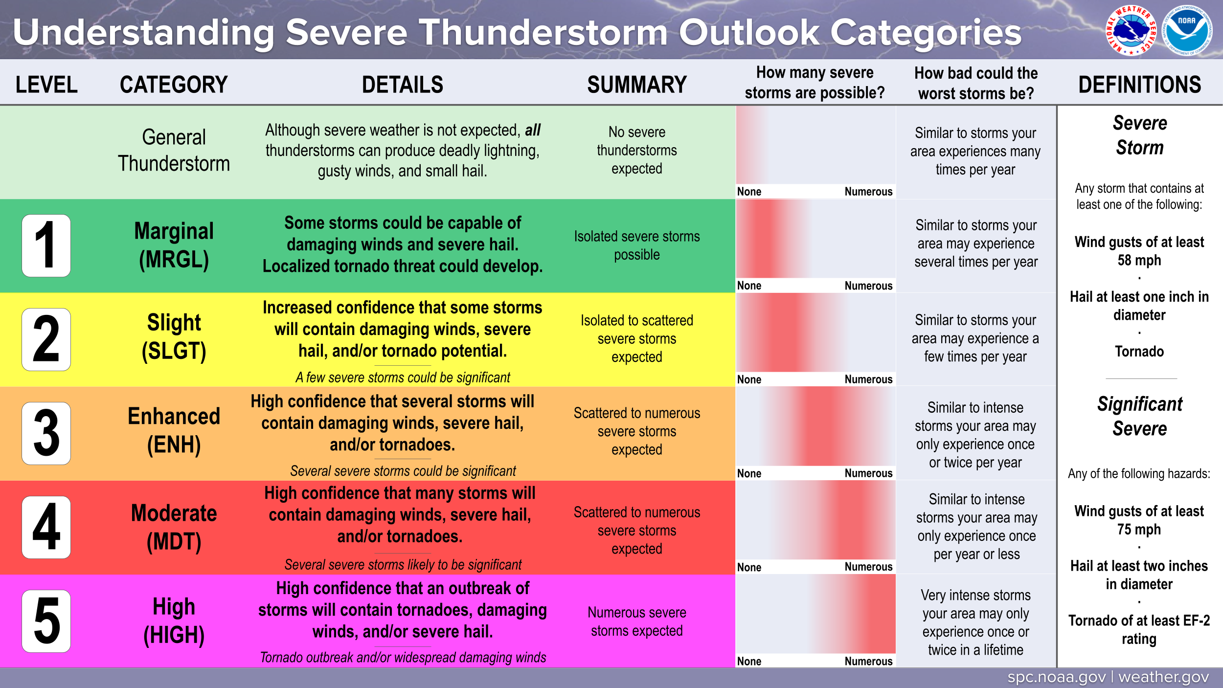
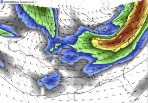
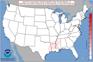
An Enhanced Risk of Severe Thunderstorms is Forecast Today and/or Tonight
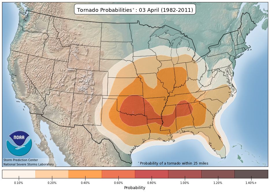
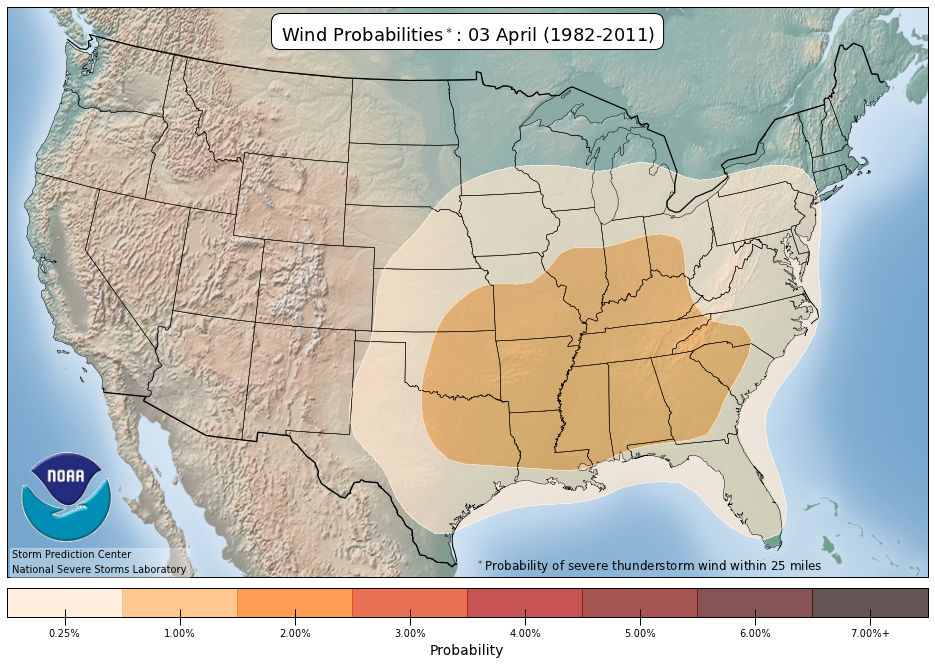
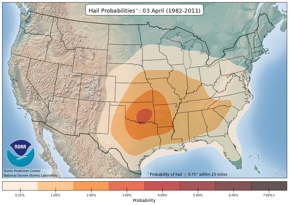
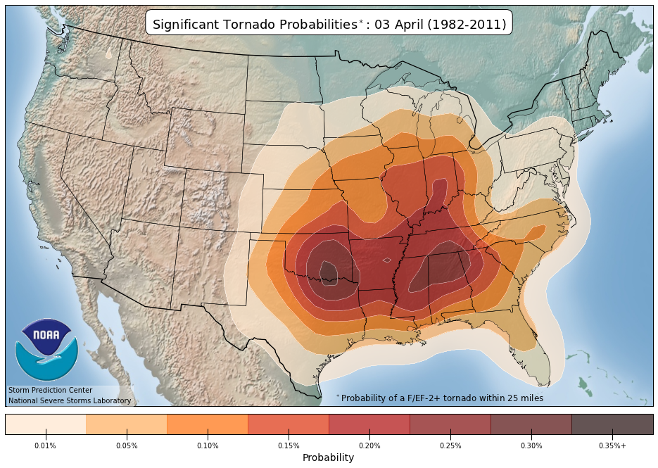
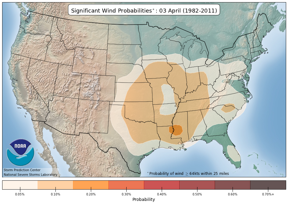
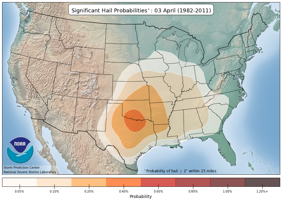
Severe thunderstorms are expected along/near a frontal zone from the southern Plains into the Tennessee Valley region. The most concentrated corridor will be from the Arklatex into western Tennessee were very large hail and a few strong tornadoes are possible.
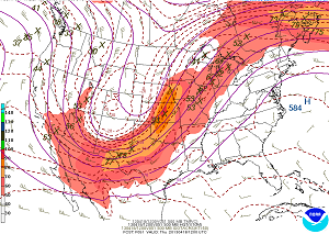
 For additional details, see the latest Day 1 Convective Outlook.
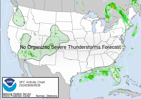

|
All Products
Watches
MDs
Outlooks
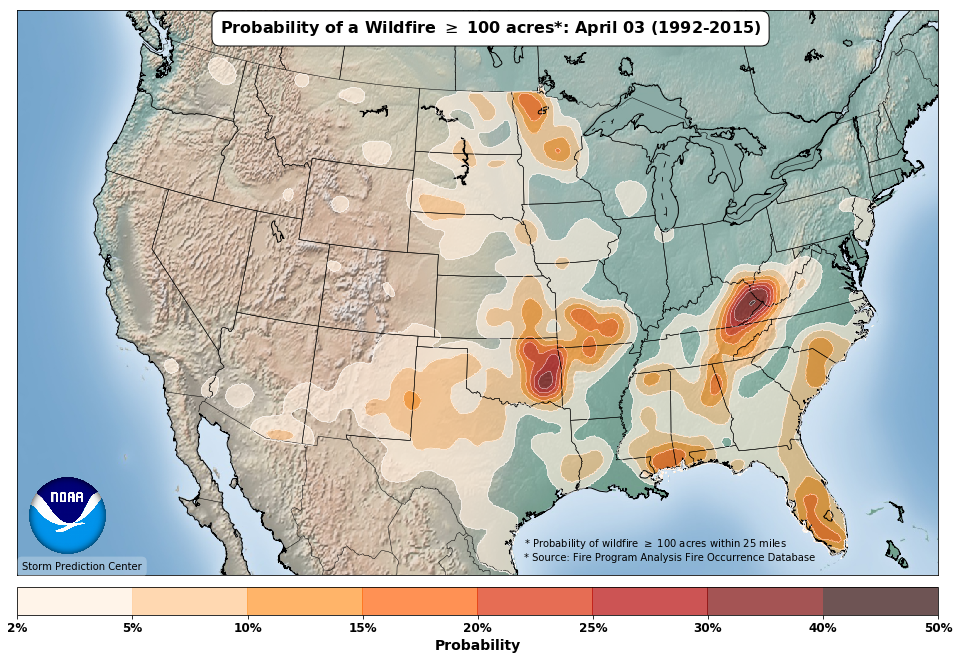
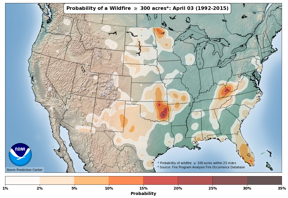
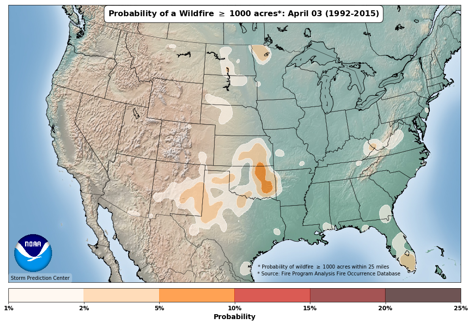
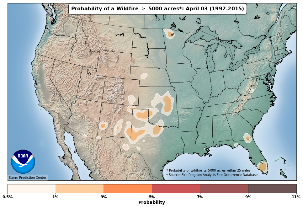
Fire
|
|
|
||||||||||||
|
|
|
||||||||||||
|
Latest SPC Publications
|
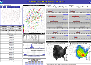
Latest SPC Case Archive
|
|||||||||||||


|
|
NOAA /
National Weather Service National Centers for Environmental Prediction Storm Prediction Center 120 David L. Boren Blvd. Norman, OK 73072 U.S.A. spc.feedback@noaa.gov Page last modified: April 03 2025 05:45 UTC |
Disclaimer Information Quality Help Glossary |
Privacy Policy Freedom of Information Act (FOIA) About Us Career Opportunities |
