SPC AC 021927
Day 3 Convective Outlook
NWS Storm Prediction Center Norman OK
0227 PM CDT Wed Apr 02 2025
Valid 041200Z - 051200Z
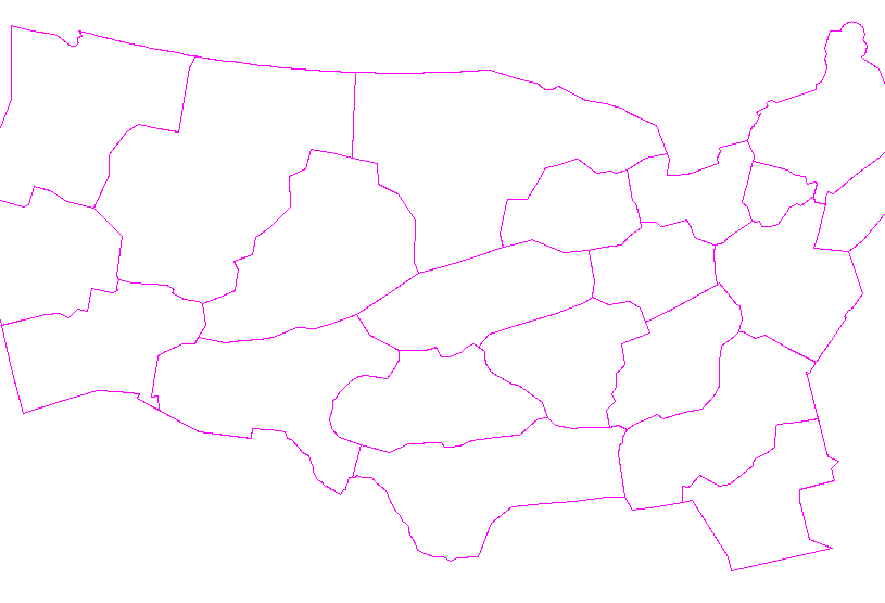
...THERE IS AN ENHANCED RISK OF SEVERE THUNDERSTORMS FROM THE
ARKLATEX TO THE MO BOOTHEEL...
...SUMMARY...
Several clusters of strong to severe storms are possible from the
Rio Grande and Red River Valleys, through the ArkLaTex and into the
lower Ohio Valley Friday and Friday night. The greatest threat for
large hail, damaging wind gusts, and tornadoes will be from the
ArkLaTex to the Missouri Bootheel.
...Synopsis...
Broad upper troughing over the western US will continue to deepen
Friday into the weekend, as an upper low forms over northern Mexico.
Flow aloft will become increasingly southerly over the southern
Plains while it curves anticyclonically over the Mid South and
eastern US. A rich pool of deep moisture will continue to reside
along a quasi stationary frontal zone from the Red River to the OH
Valley. Several clusters of strong to severe storms appear possible
within the broadly favorable zone of weak ascent and large
buoyancy/shear.
...ArkLaTex to the MO Bootheel...
An unseasonably warm/moist airmass will be in place across East
Texas and Louisiana Friday morning with mean mixing ratios of 15 to
16 g/kg forecast. During the morning, the front will move north
across Arkansas as a warm front with strong instability developing
across much of the state by mid day. During the afternoon ascent
will increase as height falls overspread the region, the low-level
jet strengthens, and the influence of the left entrance region of
the upper-level jet streak is realized. This should result in
scattered thunderstorm development during the afternoon in an
environment featuring 2500-3500 J/kg MLCAPE (per ECMWF forecast
soundings). Storms will likely develop along the surface front
during the early afternoon with greater uncertainty whether forcing
will be sufficient enough for discrete development ahead of the
front. Either way, the instability and 45-55 knots of effective
shear should be sufficient for supercells capable of all hazards
with eventual upscale growth and an increasing wind threat along the
front. The strong tornado/very large hail threat will be more
closely tied to the potential for maintenance of discrete supercells
and due to these uncertainties, no hatched area has been added at
this time.
...Ohio Valley...
Additional severe thunderstorms are possible farther northeast in
the Ohio Valley both during the day and into the overnight hours.
Weaker instability and mid-level lapse rates, in addition to ongoing
convection and cloud cover from Friday morning convection, casts
uncertainties on a greater threat. However, sufficient instability
and shear along the frontal zone should support at least some threat
for isolated to scattered severe storms.
...Central Texas to northern and northeast Texas...
Between 00Z and 06Z a mid-level jet streak is forecast to eject from
northern Mexico into south-central Texas. As this occurs, a
low-level jet will strengthen across south Texas into central Texas.
Amid 3000+ J/kg MUCAPE, initially elevated supercells are expected
to develop. As ascent continues to increase across the southern
Plains, expect additional thunderstorm development Friday night with
some severe threat persisting into Saturday morning. Eventually,
these storms will likely become surface based given the rich
moisture in place across East Texas. Moderate instability and strong
low-level shear will support a threat for all severe hazards, but
some relatively warm temperatures in the 850-700mb layer may limit a
greater severe weather threat in the absence of diurnal
destabilization.
..Bentley.. 04/02/2025
CLICK TO GET WUUS03 PTSDY3 PRODUCT
NOTE: THE NEXT DAY 3 OUTLOOK IS SCHEDULED BY 0730Z
|


 @NWSSPC