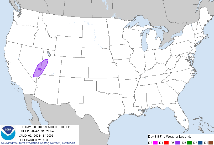
Day 3-8 Fire Weather Outlook Issued on Jul 26, 2024
Updated: Fri Jul 26 20:45:03 UTC 2024 (Print Version)
Note: Fire weather probabilistic information in
MS-Word or
PDF. Note: On February 23, 2021 the Probabilistic Day 3-8 Fire Weather Outlooks became operational. Please see the Service Change Notice 20-115 for more details.
ZCZC SPCFWDD38 ALL
FNUS28 KWNS 262041
Day 3-8 Fire Weather Outlook
NWS Storm Prediction Center Norman OK
0341 PM CDT Fri Jul 26 2024
Valid 281200Z - 031200Z
Multiple mid-level impulses will traverse the northwestern U.S. Days
3-5 (Sunday-Tuesday) before upper riding builds over the western and
central CONUS through most of next week. The passing mid-level
impulses will encourage dry and occasionally breezy conditions
across areas east of the Cascades into the Great Basin. The best
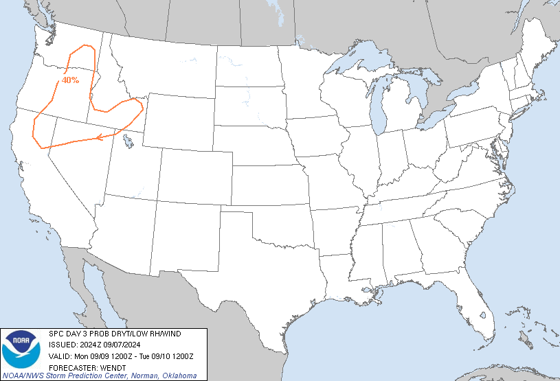
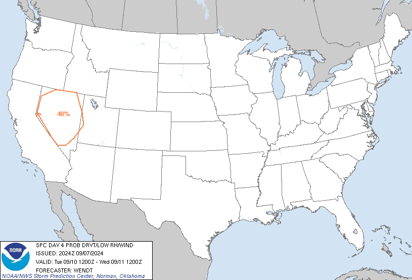
chance for Elevated equivalent meteorological surface conditions
will be over southeast Nevada into Utah on Sunday, where 40 percent
Critical probabilities have been introduced. These conditions may
persist into Monday across the same areas, as well as the lee of the
Cascades with the progression of a mid-level impulse. A stray dry
thunderstorm or two may also occur ahead of this impulse across the
northern Rockies somewhere in the Monday-Tuesday time frame, though
coverage and available buoyancy appears too marginal for dry
thunderstorm probabilities this outlook. Relatively quiescent fire
weather conditions are expected through the rest of next week across
the Interior West as mid-level impulses clear the region and upper
ridging becomes established.
..Squitieri.. 07/26/2024
...Please see www.spc.noaa.gov/fire for graphic product...
$$
CLICK TO GET FNUS38 KWNS PFWF38 FIRE WEATHER OUTLOOK DAY 3-8 AREAL OUTLINE PRODUCT


 @NWSSPC


