 Note:
The expiration time in the watch graphic is amended if the watch is
replaced, cancelled or extended.
Note:
Note:
The expiration time in the watch graphic is amended if the watch is
replaced, cancelled or extended.
Note: Click for
Watch Status Reports.
SEL2
URGENT - IMMEDIATE BROADCAST REQUESTED
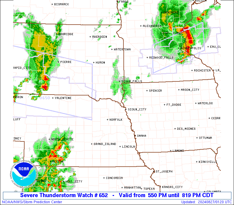
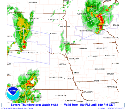
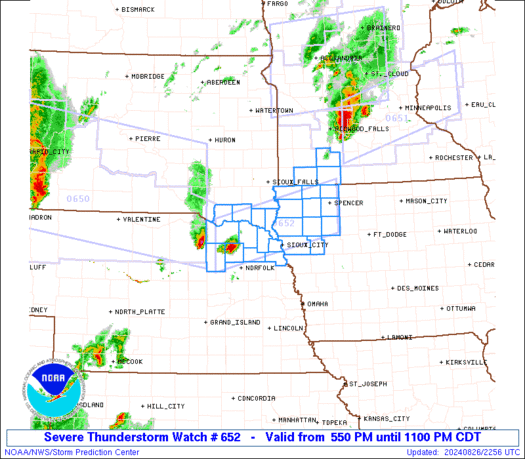
Severe Thunderstorm Watch Number 652
NWS Storm Prediction Center Norman OK
550 PM CDT Mon Aug 26 2024
The NWS Storm Prediction Center has issued a
* Severe Thunderstorm Watch for portions of
Northwest Iowa
Southwest Minnesota
Northeast Nebraska
Far Southeast South Dakota
* Effective this Monday afternoon and evening from 550 PM until
1100 PM CDT.
* Primary threats include...
Scattered large hail and isolated very large hail events to 2.5
inches in diameter likely
Scattered damaging winds and isolated significant gusts to 75
mph possible
A tornado or two possible
SUMMARY...Supercell thunderstorms should continue to move eastward
across northeast Nebraska and vicinity while posing a threat for
large hail around 1.5-2.5 inches in diameter. Severe winds mainly
around 60-70 mph may also occur, with additional intense
thunderstorms possibly developing over the next few hours along a
surface boundary into northwest Iowa and southwest Minnesota.
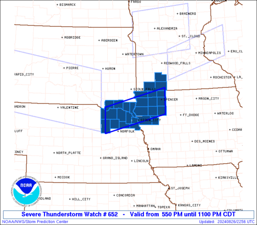
The severe thunderstorm watch area is approximately along and 35
statute miles north and south of a line from 50 miles southwest of
Yankton SD to 10 miles east southeast of Spencer IA. For a complete
depiction of the watch see the associated watch outline update
(WOUS64 KWNS WOU2).
PRECAUTIONARY/PREPAREDNESS ACTIONS...
REMEMBER...A Severe Thunderstorm Watch means conditions are
favorable for severe thunderstorms in and close to the watch area.
Persons in these areas should be on the lookout for threatening
weather conditions and listen for later statements and possible
warnings. Severe thunderstorms can and occasionally do produce
tornadoes.
&&
OTHER WATCH INFORMATION...CONTINUE...WW 648...WW 649...WW
650...WW 651...
AVIATION...A few severe thunderstorms with hail surface and aloft to
2.5 inches. Extreme turbulence and surface wind gusts to 65 knots. A
few cumulonimbi with maximum tops to 600. Mean storm motion vector
27030.
...Gleason
SEL2
URGENT - IMMEDIATE BROADCAST REQUESTED
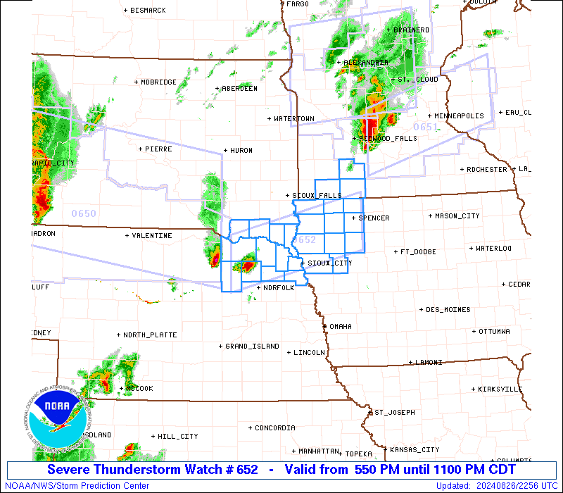
Severe Thunderstorm Watch Number 652
NWS Storm Prediction Center Norman OK
550 PM CDT Mon Aug 26 2024
The NWS Storm Prediction Center has issued a
* Severe Thunderstorm Watch for portions of
Northwest Iowa
Southwest Minnesota
Northeast Nebraska
Far Southeast South Dakota
* Effective this Monday afternoon and evening from 550 PM until
1100 PM CDT.
* Primary threats include...
Scattered large hail and isolated very large hail events to 2.5
inches in diameter likely
Scattered damaging winds and isolated significant gusts to 75
mph possible
A tornado or two possible
SUMMARY...Supercell thunderstorms should continue to move eastward
across northeast Nebraska and vicinity while posing a threat for
large hail around 1.5-2.5 inches in diameter. Severe winds mainly
around 60-70 mph may also occur, with additional intense
thunderstorms possibly developing over the next few hours along a
surface boundary into northwest Iowa and southwest Minnesota.
The severe thunderstorm watch area is approximately along and 35
statute miles north and south of a line from 50 miles southwest of
Yankton SD to 10 miles east southeast of Spencer IA. For a complete
depiction of the watch see the associated watch outline update
(WOUS64 KWNS WOU2).
PRECAUTIONARY/PREPAREDNESS ACTIONS...
REMEMBER...A Severe Thunderstorm Watch means conditions are
favorable for severe thunderstorms in and close to the watch area.
Persons in these areas should be on the lookout for threatening
weather conditions and listen for later statements and possible
warnings. Severe thunderstorms can and occasionally do produce
tornadoes.
&&
OTHER WATCH INFORMATION...CONTINUE...WW 648...WW 649...WW
650...WW 651...
AVIATION...A few severe thunderstorms with hail surface and aloft to
2.5 inches. Extreme turbulence and surface wind gusts to 65 knots. A
few cumulonimbi with maximum tops to 600. Mean storm motion vector
27030.
...Gleason
 Note:
The Aviation Watch (SAW) product is an approximation to the watch area.
The actual watch is depicted by the shaded areas.
Note:
The Aviation Watch (SAW) product is an approximation to the watch area.
The actual watch is depicted by the shaded areas.
   SAW2
   WW 652 SEVERE TSTM IA MN NE SD 262250Z - 270400Z
   AXIS..35 STATUTE MILES NORTH AND SOUTH OF LINE..
   50SW YKN/YANKTON SD/ - 10ESE SPW/SPENCER IA/
   ..AVIATION COORDS.. 30NM N/S /28E ONL - 42NW FOD/
   HAIL SURFACE AND ALOFT..2.5 INCHES. WIND GUSTS..65 KNOTS.
   MAX TOPS TO 600. MEAN STORM MOTION VECTOR 27030.

   LAT...LON 42919807 43629497 42619497 41909807

   THIS IS AN APPROXIMATION TO THE WATCH AREA.  FOR A
   COMPLETE DEPICTION OF THE WATCH SEE WOUS64 KWNS
   FOR WOU2.
Watch 652 Status Report Messages:
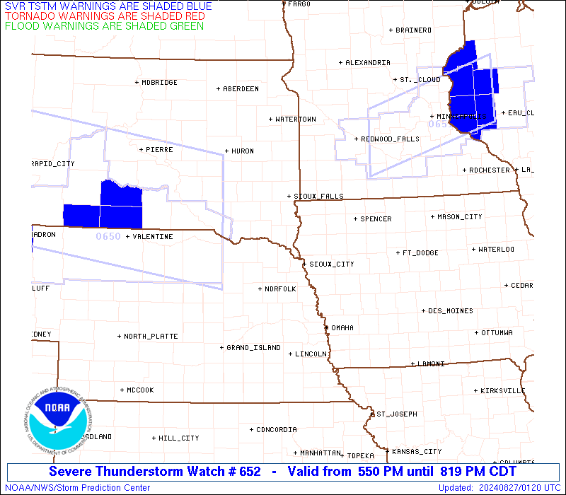
STATUS REPORT #1 ON WW 652

VALID 262330Z - 270040Z

THE SEVERE WEATHER THREAT CONTINUES ACROSS THE ENTIRE WATCH AREA.

..SQUITIERI..08/26/24

ATTN...WFO...FSD...OAX...

&&

STATUS REPORT FOR WS 652

SEVERE WEATHER THREAT CONTINUES FOR THE FOLLOWING AREAS

IAC021-035-041-059-093-119-141-143-149-167-193-270040-

IA
.    IOWA COUNTIES INCLUDED ARE

BUENA VISTA	     CHEROKEE		 CLAY
DICKINSON	     IDA		 LYON
O'BRIEN 	     OSCEOLA		 PLYMOUTH
SIOUX		     WOODBURY
$$


MNC033-063-105-270040-

MN
.    MINNESOTA COUNTIES INCLUDED ARE

COTTONWOOD	     JACKSON		 NOBLES
$$


NEC003-027-043-051-107-139-173-179-270040-

NE
.    NEBRASKA COUNTIES INCLUDED ARE

ANTELOPE	     CEDAR		 DAKOTA
DIXON		     KNOX		 PIERCE
THURSTON	     WAYNE
$$


SDC009-027-127-135-270040-

SD
.    SOUTH DAKOTA COUNTIES INCLUDED ARE

BON HOMME	     CLAY		 UNION
YANKTON
$$


THE WATCH STATUS MESSAGE IS FOR GUIDANCE PURPOSES ONLY.  PLEASE
REFER TO WATCH COUNTY NOTIFICATION STATEMENTS FOR OFFICIAL
INFORMATION ON COUNTIES...INDEPENDENT CITIES AND MARINE ZONES
CLEARED FROM SEVERE THUNDERSTORM AND TORNADO WATCHES.
$$
Note:
Click for Complete Product Text.
Tornadoes
Probability of 2 or more tornadoes
|
Low (20%)
|
Probability of 1 or more strong (EF2-EF5) tornadoes
|
Low (10%)
|
Wind
Probability of 10 or more severe wind events
|
Mod (40%)
|
Probability of 1 or more wind events > 65 knots
|
Mod (30%)
|
Hail
Probability of 10 or more severe hail events
|
Mod (60%)
|
Probability of 1 or more hailstones > 2 inches
|
Mod (60%)
|
Combined Severe Hail/Wind
Probability of 6 or more combined severe hail/wind events
|
High (80%)
|
For each watch, probabilities for particular events inside the watch
(listed above in each table) are determined by the issuing forecaster.
The "Low" category contains probability values ranging from less than 2%
to 20% (EF2-EF5 tornadoes), less than 5% to 20% (all other probabilities),
"Moderate" from 30% to 60%, and "High" from 70% to greater than 95%.
High values are bolded and lighter in color to provide awareness of
an increased threat for a particular event.


 @NWSSPC