Note:
The expiration time in the watch graphic is amended if the watch is
replaced, cancelled or extended.
Note:
Note:
The expiration time in the watch graphic is amended if the watch is
replaced, cancelled or extended.
Note: Click for
Watch Status Reports.
SEL5
URGENT - IMMEDIATE BROADCAST REQUESTED
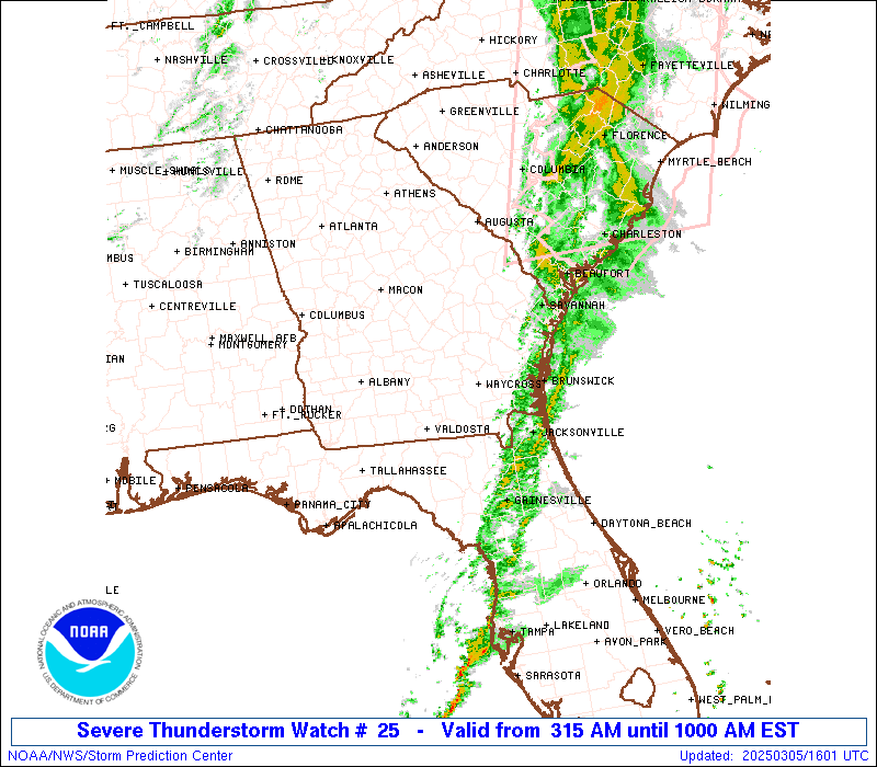
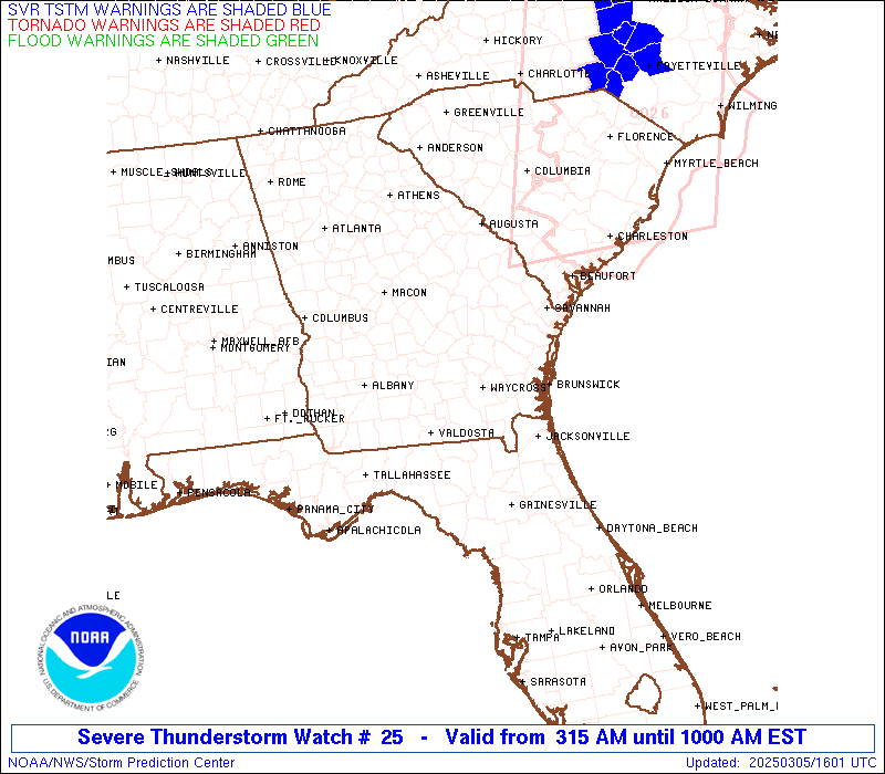
Severe Thunderstorm Watch Number 25
NWS Storm Prediction Center Norman OK
315 AM EST Wed Mar 5 2025
The NWS Storm Prediction Center has issued a
* Severe Thunderstorm Watch for portions of
North Florida
Southern into Southeast Georgia
Southern South Carolina
Coastal Waters
* Effective this Wednesday morning from 315 AM until 1000 AM EST.
* Primary threats include...
Scattered damaging wind gusts to 70 mph possible
A tornado or two possible
SUMMARY...A squall line will move eastward across the Watch area
overnight into the morning. Damaging gusts ranging 55-70 mph are
possible with the stronger inflections and bowing segments within
the convective line. A brief tornado is also possible.
The severe thunderstorm watch area is approximately along and 90
statute miles east and west of a line from 55 miles north northeast
of Vidalia GA to 55 miles south of Valdosta GA. For a complete
depiction of the watch see the associated watch outline update
(WOUS64 KWNS WOU5).
PRECAUTIONARY/PREPAREDNESS ACTIONS...
REMEMBER...A Severe Thunderstorm Watch means conditions are
favorable for severe thunderstorms in and close to the watch area.
Persons in these areas should be on the lookout for threatening
weather conditions and listen for later statements and possible
warnings. Severe thunderstorms can and occasionally do produce
tornadoes.
&&
OTHER WATCH INFORMATION...CONTINUE...WW 23...WW 24...
AVIATION...A few severe thunderstorms with hail surface and aloft to
0.5 inches. Extreme turbulence and surface wind gusts to 60 knots. A
few cumulonimbi with maximum tops to 350. Mean storm motion vector
26035.
...Smith
 Note:
The Aviation Watch (SAW) product is an approximation to the watch area.
The actual watch is depicted by the shaded areas.
Note:
The Aviation Watch (SAW) product is an approximation to the watch area.
The actual watch is depicted by the shaded areas.
SAW5
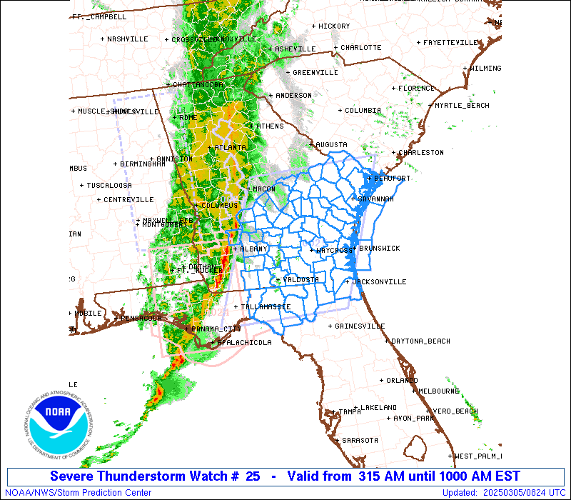
WW 25 SEVERE TSTM FL GA SC CW 050815Z - 051500Z
AXIS..90 STATUTE MILES EAST AND WEST OF LINE..
55NNE VDI/VIDALIA GA/ - 55S VLD/VALDOSTA GA/
..AVIATION COORDS.. 80NM E/W /48S IRQ - 26NNW CTY/
HAIL SURFACE AND ALOFT..0.5 INCH. WIND GUSTS..60 KNOTS.
MAX TOPS TO 350. MEAN STORM MOTION VECTOR 26035.
LAT...LON 32918046 29988178 29988478 32918356
THIS IS AN APPROXIMATION TO THE WATCH AREA. FOR A
COMPLETE DEPICTION OF THE WATCH SEE WOUS64 KWNS
FOR WOU5.
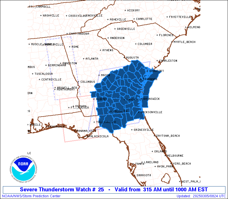
Watch 25 Status Report Messages:
STATUS REPORT #3 ON WW 25
VALID 051425Z - 051540Z
SEVERE WEATHER THREAT CONTINUES RIGHT OF A LINE FROM 25 NE CTY TO
35 SSE AYS TO 35 ENE AYS TO 30 WSW SAV TO 30 SSW OGB TO 30 SSW
OGB.
..BENTLEY..03/05/25
ATTN...WFO...JAX...TAE...FFC...CHS...
&&
STATUS REPORT FOR WS 25
SEVERE WEATHER THREAT CONTINUES FOR THE FOLLOWING AREAS
FLC003-023-031-089-051540-
FL
. FLORIDA COUNTIES INCLUDED ARE
BAKER COLUMBIA DUVAL
NASSAU
$$
GAC025-029-039-049-051-103-127-179-183-191-305-051540-
GA
. GEORGIA COUNTIES INCLUDED ARE
BRANTLEY BRYAN CAMDEN
CHARLTON CHATHAM EFFINGHAM
GLYNN LIBERTY LONG
MCINTOSH WAYNE
$$
SCC013-049-053-051540-
SC
. SOUTH CAROLINA COUNTIES INCLUDED ARE
BEAUFORT HAMPTON JASPER
$$
AMZ352-354-450-051540-
CW
. ADJACENT COASTAL WATERS INCLUDED ARE
COASTAL WATERS FROM EDISTO BEACH SC TO SAVANNAH GA OUT 20 NM
COASTAL WATERS FROM SAVANNAH GA TO ALTAMAHA SOUND GA OUT 20 NM
...INCLUDING GRAYS REEF NATIONAL MARINE SANCTUARY
COASTAL WATERS FROM ALTAMAHA SOUND TO FERNANDINA BEACH FL OUT 20
NM
$$
THE WATCH STATUS MESSAGE IS FOR GUIDANCE PURPOSES ONLY. PLEASE
REFER TO WATCH COUNTY NOTIFICATION STATEMENTS FOR OFFICIAL
INFORMATION ON COUNTIES...INDEPENDENT CITIES AND MARINE ZONES
CLEARED FROM SEVERE THUNDERSTORM AND TORNADO WATCHES.
$$
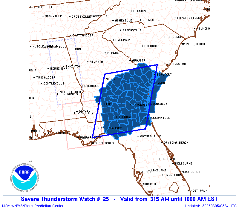
STATUS REPORT #2 ON WW 25
VALID 051310Z - 051440Z
SEVERE WEATHER THREAT CONTINUES RIGHT OF A LINE FROM 20 W CTY TO
30 E VLD TO 20 NNE AYS TO 35 ESE VDI TO 40 NNW SAV TO 20 SW OGB.
..JEWELL..03/05/25
ATTN...WFO...JAX...TAE...FFC...CHS...
&&
STATUS REPORT FOR WS 25
SEVERE WEATHER THREAT CONTINUES FOR THE FOLLOWING AREAS
FLC003-023-031-047-067-089-121-051440-
FL
. FLORIDA COUNTIES INCLUDED ARE
BAKER COLUMBIA DUVAL
HAMILTON LAFAYETTE NASSAU
SUWANNEE
$$
GAC025-029-039-049-051-101-103-127-179-183-191-229-267-299-305-
051440-
GA
. GEORGIA COUNTIES INCLUDED ARE
BRANTLEY BRYAN CAMDEN
CHARLTON CHATHAM ECHOLS
EFFINGHAM GLYNN LIBERTY
LONG MCINTOSH PIERCE
TATTNALL WARE WAYNE
$$
SCC005-013-049-053-051440-
SC
. SOUTH CAROLINA COUNTIES INCLUDED ARE
ALLENDALE BEAUFORT HAMPTON
JASPER
$$
AMZ352-354-450-051440-
CW
. ADJACENT COASTAL WATERS INCLUDED ARE
COASTAL WATERS FROM EDISTO BEACH SC TO SAVANNAH GA OUT 20 NM
COASTAL WATERS FROM SAVANNAH GA TO ALTAMAHA SOUND GA OUT 20 NM
...INCLUDING GRAYS REEF NATIONAL MARINE SANCTUARY
COASTAL WATERS FROM ALTAMAHA SOUND TO FERNANDINA BEACH FL OUT 20
NM
$$
THE WATCH STATUS MESSAGE IS FOR GUIDANCE PURPOSES ONLY. PLEASE
REFER TO WATCH COUNTY NOTIFICATION STATEMENTS FOR OFFICIAL
INFORMATION ON COUNTIES...INDEPENDENT CITIES AND MARINE ZONES
CLEARED FROM SEVERE THUNDERSTORM AND TORNADO WATCHES.
$$
STATUS REPORT #1 ON WW 25
VALID 051150Z - 051500Z
SEVERE WEATHER THREAT CONTINUES RIGHT OF A LINE FROM 50 SSE TLH
TO 10 WSW VLD TO 35 W AYS TO 25 SSW VDI TO 35 NNE VDI TO 15 SSE
AGS.
WW 25 WILL BE ALLOWED TO EXPIRE AT 051500Z.
..JEWELL..03/05/25
ATTN...WFO...JAX...TAE...FFC...CHS...
&&
STATUS REPORT FOR WS 25
SEVERE WEATHER THREAT CONTINUES FOR THE FOLLOWING AREAS
FLC003-023-031-047-067-079-089-121-123-051500-
FL
. FLORIDA COUNTIES INCLUDED ARE
BAKER COLUMBIA DUVAL
HAMILTON LAFAYETTE MADISON
NASSAU SUWANNEE TAYLOR
$$
GAC001-003-005-025-029-031-039-043-049-051-065-101-103-109-127-
165-173-179-183-185-191-229-251-267-279-299-305-051500-
GA
. GEORGIA COUNTIES INCLUDED ARE
APPLING ATKINSON BACON
BRANTLEY BRYAN BULLOCH
CAMDEN CANDLER CHARLTON
CHATHAM CLINCH ECHOLS
EFFINGHAM EVANS GLYNN
JENKINS LANIER LIBERTY
LONG LOWNDES MCINTOSH
PIERCE SCREVEN TATTNALL
TOOMBS WARE WAYNE
$$
SCC005-013-049-053-051500-
SC
. SOUTH CAROLINA COUNTIES INCLUDED ARE
ALLENDALE BEAUFORT HAMPTON
JASPER
$$
AMZ352-354-450-051500-
CW
. ADJACENT COASTAL WATERS INCLUDED ARE
COASTAL WATERS FROM EDISTO BEACH SC TO SAVANNAH GA OUT 20 NM
COASTAL WATERS FROM SAVANNAH GA TO ALTAMAHA SOUND GA OUT 20 NM
...INCLUDING GRAYS REEF NATIONAL MARINE SANCTUARY
COASTAL WATERS FROM ALTAMAHA SOUND TO FERNANDINA BEACH FL OUT 20
NM
$$
THE WATCH STATUS MESSAGE IS FOR GUIDANCE PURPOSES ONLY. PLEASE
REFER TO WATCH COUNTY NOTIFICATION STATEMENTS FOR OFFICIAL
INFORMATION ON COUNTIES...INDEPENDENT CITIES AND MARINE ZONES
CLEARED FROM SEVERE THUNDERSTORM AND TORNADO WATCHES.
$$
Note:
Click for Complete Product Text.
Tornadoes
Probability of 2 or more tornadoes
|
Low (20%)
|
Probability of 1 or more strong (EF2-EF5) tornadoes
|
Low (<2%)
|
Wind
Probability of 10 or more severe wind events
|
Mod (40%)
|
Probability of 1 or more wind events > 65 knots
|
Low (20%)
|
Hail
Probability of 10 or more severe hail events
|
Low (<5%)
|
Probability of 1 or more hailstones > 2 inches
|
Low (<5%)
|
Combined Severe Hail/Wind
Probability of 6 or more combined severe hail/wind events
|
Mod (60%)
|
For each watch, probabilities for particular events inside the watch
(listed above in each table) are determined by the issuing forecaster.
The "Low" category contains probability values ranging from less than 2%
to 20% (EF2-EF5 tornadoes), less than 5% to 20% (all other probabilities),
"Moderate" from 30% to 60%, and "High" from 70% to greater than 95%.
High values are bolded and lighter in color to provide awareness of
an increased threat for a particular event.


 @NWSSPC