SPC AC 131930
Day 3 Convective Outlook
NWS Storm Prediction Center Norman OK
0230 PM CDT Thu Mar 13 2025
Valid 151200Z - 161200Z
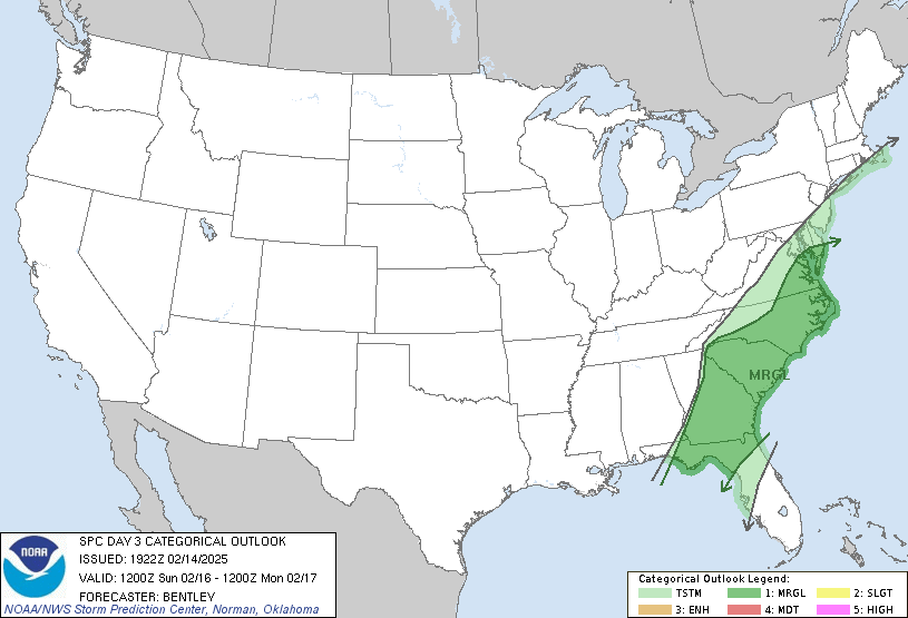
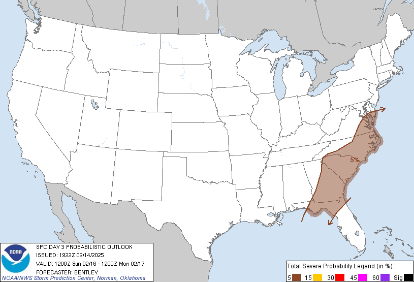
...THERE IS A MODERATE RISK OF SEVERE THUNDERSTORMS IN EASTERN
LA...MS...AND AL...
...SUMMARY...
A severe weather outbreak is expected on Saturday across the central
Gulf Coast States and Deep South into the Tennessee Valley. Numerous
significant tornadoes are possible on Saturday afternoon and
evening, centered on eastern Louisiana, Mississippi, and Alabama.
Widespread damaging wind swaths and scattered large hail are likely.
...Central Gulf Coast/Deep South/TN Valley...
Primary change is to expand level 4-MDT north in AL and all
categories west in the tight gradient of severe potential from the
Sabine to Lower MS Valleys. A particularly volatile scenario for
destructive severe remains evident during the afternoon to evening
on Saturday centered on the level 4-MDT risk region.
In the wake of the vigorous shortwave trough and very deep surface
cyclone crossing the North-Central States on D2, a broad upper
trough will linger across the southern Great Plains. An intense
mid-level jetlet, in excess of 100 kts at 500-mb, should eject
through the basal portion of this trough in south TX on Saturday
afternoon. This will induce secondary cyclogenesis along the
slow-moving baroclinic zone from the Ark-La-Tex to the central Great
Lakes. Another day of air mass modification ahead of this wave will
yield a pronounced plume of rich northwest Gulf moisture that should
be pristine across southeast LA into central MS through late
morning. As mid-level height falls overspread the diurnally warming
air mass, increasing convective development is expected along the
deepening baroclinic zone, as well as residual outflows to its
northeast in the TN Valley from prior late D2 convection.
Steep mid-level lapse rates atop the richly moist boundary layer
should yield at least moderate MLCAPE across the Lower MS Valley.
Vertically veering wind profiles with strong anvil-level divergence
amid the favorable instability should support robust updrafts and
intense supercells. Low-level shear will strengthen during the
afternoon and evening, setting the stage for a severe-weather
outbreak including significant tornadoes, damaging gusts, and large
hail. A pronounced dropoff in severe may be realized with northward
extent across the TN Valley as an emerging band and/or highly
organized line outpaces the rich Gulf air. Despite weaker
instability with eastern extent into GA/SC, the intense wind fields
may sustain damaging wind and embedded tornado potential well into
the overnight.
...OH Valley to Lower Great Lakes...
Forecast confidence is low with regard to severe potential north of
the TN Valley. Weakening late D2 convection should be in a decaying
process at 12Z Saturday. Much of the region will then be in between
waves until late afternoon. Guidance differs on the degree of
diurnal destabilization ahead of the deepening surface cyclone that
should track north-northeast from the Ark-La-Tex. It is plausible
that widespread Mid/Deep South to TN Valley convection during the
day Saturday will temper the northward extent of instability by
Saturday evening/night within a predominately meridional deep-layer
wind profile. As such, the overall severe risk appears conditional,
but given the fast flow regime, potential for damaging winds and
perhaps a few tornadoes may be realized.
..Grams.. 03/13/2025
NOTE: THE NEXT DAY 3 OUTLOOK IS SCHEDULED BY 0730Z