|
| Mesoscale Discussion 2082 |
|
< Previous MD Next MD >
|

|
   Mesoscale Discussion 2082
   NWS Storm Prediction Center Norman OK
   0641 PM CDT Tue Sep 17 2024

   Areas affected...Central High Plains

   Concerning...Severe Thunderstorm Watch 674...675...

   Valid 172341Z - 180145Z

   The severe weather threat for Severe Thunderstorm Watch 674, 675
   continues.

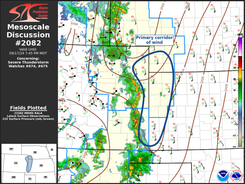
   SUMMARY...Strong winds are the primary risk along the leading edge
   of a squall line as it propagates across the central High Plains.

   DISCUSSION...Early-evening water-vapor imagery suggests mid-level
   short-wave trough is located over southeast CO, ejecting northeast
   into the central High Plains. Organized convection has evolved ahead
   of this feature, primarily expressed as a squall line which extends
   from southwest Yuma County CO-Baca County CO. Strong winds are
   likely associated with this squall line, and this is the primary
   risk as the squall line advances into western KS/southwest NE over
   the next 1-2 hours.

   ..Darrow.. 09/17/2024

   ...Please see www.spc.noaa.gov for graphic product...

   ATTN...WFO...LBF...DDC...GLD...PUB...BOU...

   LAT...LON   37460250 39190230 40240282 40790133 39720082 37380154
               37460250
|
|
Top/All Mesoscale Discussions/Forecast Products/Home
|
|


