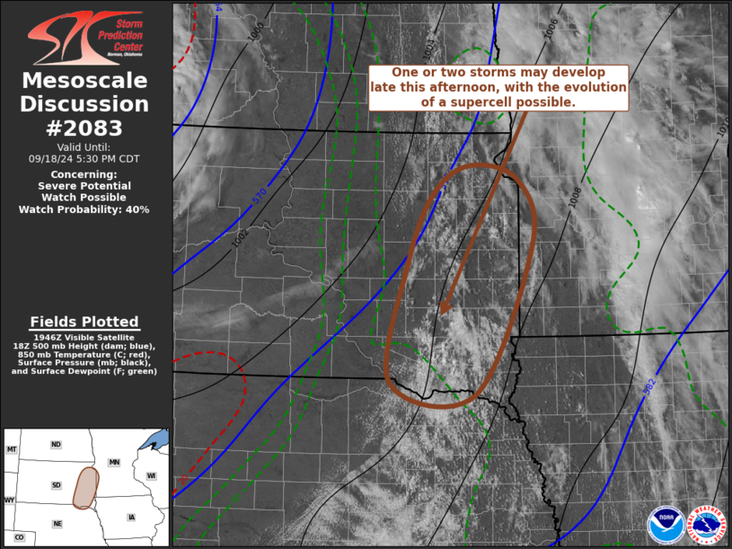
   Mesoscale Discussion 2083
   NWS Storm Prediction Center Norman OK
   0253 PM CDT Wed Sep 18 2024

   Areas affected...parts of eastern South Dakota...adjacent
   northeastern Nebraska and southwestern Minnesota

   Concerning...Severe potential...Watch possible

   Valid 181953Z - 182230Z

   Probability of Watch Issuance...40 percent

   SUMMARY...The initiation of one or two strong storms appears
   possible late this afternoon.  Sustained storm development may
   include the evolution of supercell structures posing a risk for
   severe hail, and perhaps some potential for a tornado by early
   evening.  Due to the isolated nature, it is not certain that a
   severe weather watch is needed, but trends are being monitored.

   DISCUSSION...Although stronger mid-level height falls appear to be
   shifting to the north, a destabilizing warm sector boundary layer
   across the eastern South Dakota vicinity will remain beneath weakly
   difluent cyclonic mid-level flow into early evening.  With
   mixed-layer CAPE now on the order of 1500 J/kg, beneath 30-50 kt
   southwesterly mid/upper flow, the environment appears at least
   conditionally supportive of supercells, and low-level hodographs may
   enlarge with clockwise curvature as southerly flow around 850 mb is
   forecast to strengthen some (to around 30+ kt) through 22-00Z.

   Although low-level forcing for sustained convective development
   remains unclear, weak warm advection to the east of the dryline may
   be supporting ongoing attempts at deepening convection east of Huron
   into the Watertown vicinity.  And objective analysis has indicated a
   persistent localized area of enhanced convergence along a confluence
   zone near/west of Yankton.

   Model output, including the convection allowing guidance, suggest
   that probabilities for thunderstorm development are generally low
   into early evening.  However, the initiation of one or two storms
   appears possible.  If this is sustained, this may include the
   evolution of supercell structures posing a risk for severe hail, and
   perhaps some potential for a tornado.

   ..Kerr/Gleason.. 09/18/2024

   ...Please see www.spc.noaa.gov for graphic product...

   ATTN...WFO...MPX...FSD...OAX...ABR...LBF...

   LAT...LON   45389647 44609622 42819716 42949859 44379830 45219788
               45549726 45389647
|


 @NWSSPC