 Note:
The expiration time in the watch graphic is amended if the watch is
replaced, cancelled or extended.
Note:
Note:
The expiration time in the watch graphic is amended if the watch is
replaced, cancelled or extended.
Note: Click for
Watch Status Reports.
SEL1
URGENT - IMMEDIATE BROADCAST REQUESTED
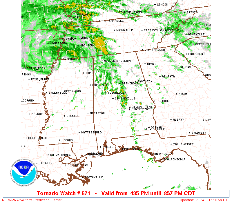
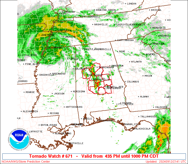
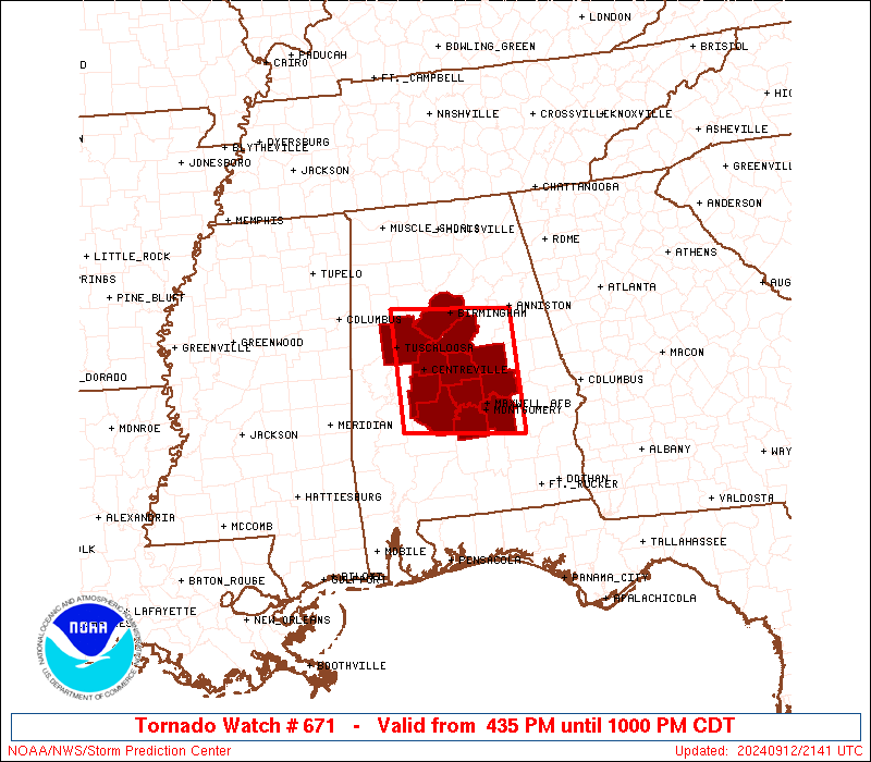
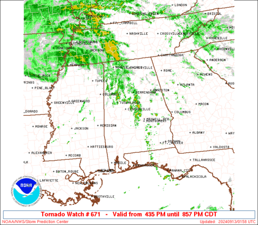
Tornado Watch Number 671
NWS Storm Prediction Center Norman OK
435 PM CDT Thu Sep 12 2024
The NWS Storm Prediction Center has issued a
* Tornado Watch for portions of
Central Alabama
* Effective this Thursday afternoon and evening from 435 PM until
1000 PM CDT.
* Primary threats include...
A couple tornadoes possible
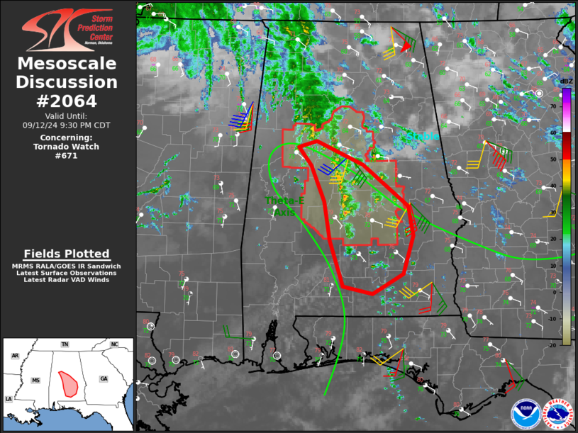
SUMMARY...A convective band within a moist and strongly sheared
environment will feature embedded quasi-discrete updrafts late this
afternoon into the evening. Several supercells will potentially
pose a tornado risk before instability wanes late this evening.
The tornado watch area is approximately along and 55 statute miles
north and south of a line from 55 miles northwest of Selma AL to 45
miles northeast of Montgomery AL. For a complete depiction of the
watch see the associated watch outline update (WOUS64 KWNS WOU1).
PRECAUTIONARY/PREPAREDNESS ACTIONS...
REMEMBER...A Tornado Watch means conditions are favorable for
tornadoes and severe thunderstorms in and close to the watch
area. Persons in these areas should be on the lookout for
threatening weather conditions and listen for later statements
and possible warnings.
&&
OTHER WATCH INFORMATION...CONTINUE...WW 670...
AVIATION...Tornadoes and a few severe thunderstorms with hail
surface and aloft to 0 inches. Extreme turbulence and surface wind
gusts to 50 knots. A few cumulonimbi with maximum tops to 400. Mean
storm motion vector 20020.
...Smith
 Note:
The Aviation Watch (SAW) product is an approximation to the watch area.
The actual watch is depicted by the shaded areas.
Note:
The Aviation Watch (SAW) product is an approximation to the watch area.
The actual watch is depicted by the shaded areas.
   SAW1
   WW 671 TORNADO AL 122135Z - 130300Z
   AXIS..55 STATUTE MILES NORTH AND SOUTH OF LINE..
   55NW SEM/SELMA AL/ - 45NE MGM/MONTGOMERY AL/
   ..AVIATION COORDS.. 50NM N/S /55SE IGB - 37WSW LGC/
   WIND GUSTS..50 KNOTS.
   MAX TOPS TO 400.MEAN STORM MOTION VECTOR 20020.

   LAT...LON 33718765 33558585 31958585 32128765

   THIS IS AN APPROXIMATION TO THE WATCH AREA.  FOR A
   COMPLETE DEPICTION OF THE WATCH SEE WOUS64 KWNS
   FOR WOU1.
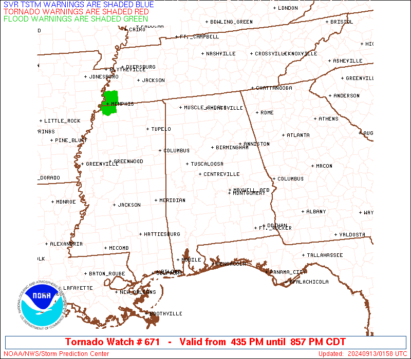
Watch 671 Status Report Messages:
STATUS REPORT #1 ON WW 671

VALID 130055Z - 130140Z

SEVERE WEATHER THREAT CONTINUES RIGHT OF A LINE FROM 30 SSE SEM
TO 30 NNE SEM TO 30 WNW BHM.

FOR ADDITIONAL INFORMATION SEE MESOSCALE DISCUSSION 2064

..JEWELL..09/13/24

ATTN...WFO...BMX...

&&

STATUS REPORT FOR WT 671

SEVERE WEATHER THREAT CONTINUES FOR THE FOLLOWING AREAS

ALC001-021-037-051-073-085-101-117-130140-

AL
.    ALABAMA COUNTIES INCLUDED ARE

AUTAUGA 	     CHILTON		 COOSA
ELMORE		     JEFFERSON		 LOWNDES
MONTGOMERY	     SHELBY
$$


THE WATCH STATUS MESSAGE IS FOR GUIDANCE PURPOSES ONLY.  PLEASE
REFER TO WATCH COUNTY NOTIFICATION STATEMENTS FOR OFFICIAL
INFORMATION ON COUNTIES...INDEPENDENT CITIES AND MARINE ZONES
CLEARED FROM SEVERE THUNDERSTORM AND TORNADO WATCHES.
$$
Note:
Click for Complete Product Text.
Tornadoes
Probability of 2 or more tornadoes
|
Mod (40%)
|
Probability of 1 or more strong (EF2-EF5) tornadoes
|
Low (20%)
|
Wind
Probability of 10 or more severe wind events
|
Low (<5%)
|
Probability of 1 or more wind events > 65 knots
|
Low (<5%)
|
Hail
Probability of 10 or more severe hail events
|
Low (<5%)
|
Probability of 1 or more hailstones > 2 inches
|
Low (<5%)
|
Combined Severe Hail/Wind
Probability of 6 or more combined severe hail/wind events
|
Low (20%)
|
For each watch, probabilities for particular events inside the watch
(listed above in each table) are determined by the issuing forecaster.
The "Low" category contains probability values ranging from less than 2%
to 20% (EF2-EF5 tornadoes), less than 5% to 20% (all other probabilities),
"Moderate" from 30% to 60%, and "High" from 70% to greater than 95%.
High values are bolded and lighter in color to provide awareness of
an increased threat for a particular event.


 @NWSSPC