 Note:
The expiration time in the watch graphic is amended if the watch is
replaced, cancelled or extended.
Note:
Note:
The expiration time in the watch graphic is amended if the watch is
replaced, cancelled or extended.
Note: Click for
Watch Status Reports.
SEL0
URGENT - IMMEDIATE BROADCAST REQUESTED
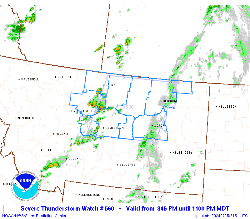
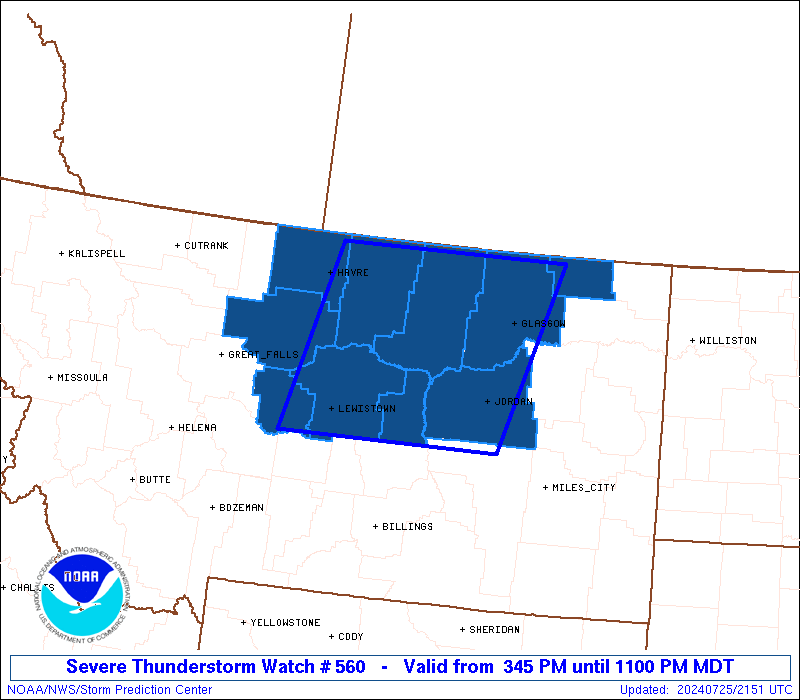
Severe Thunderstorm Watch Number 560
NWS Storm Prediction Center Norman OK
345 PM MDT Thu Jul 25 2024
The NWS Storm Prediction Center has issued a
* Severe Thunderstorm Watch for portions of
North Central Montana
* Effective this Thursday afternoon and evening from 345 PM until
1100 PM MDT.
* Primary threats include...
Scattered damaging winds likely with isolated significant gusts
to 75 mph possible
Isolated large hail events to 1.5 inches in diameter possible
SUMMARY...Thunderstorms will continue to intensify over
north-central Montana and track quickly eastward through the
afternoon and evening. Damaging wind gusts are the main threat with
these storms.
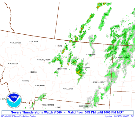
The severe thunderstorm watch area is approximately along and 85
statute miles east and west of a line from 50 miles east southeast
of Lewistown MT to 70 miles northwest of Glasgow MT. For a complete
depiction of the watch see the associated watch outline update
(WOUS64 KWNS WOU0).
PRECAUTIONARY/PREPAREDNESS ACTIONS...
REMEMBER...A Severe Thunderstorm Watch means conditions are
favorable for severe thunderstorms in and close to the watch area.
Persons in these areas should be on the lookout for threatening
weather conditions and listen for later statements and possible
warnings. Severe thunderstorms can and occasionally do produce
tornadoes.
&&
AVIATION...A few severe thunderstorms with hail surface and aloft to
1.5 inches. Extreme turbulence and surface wind gusts to 65 knots. A
few cumulonimbi with maximum tops to 500. Mean storm motion vector
24035.
...Hart
 Note:
The Aviation Watch (SAW) product is an approximation to the watch area.
The actual watch is depicted by the shaded areas.
Note:
The Aviation Watch (SAW) product is an approximation to the watch area.
The actual watch is depicted by the shaded areas.
   SAW0
   WW 560 SEVERE TSTM MT 252145Z - 260500Z
   AXIS..85 STATUTE MILES EAST AND WEST OF LINE..
   50ESE LWT/LEWISTOWN MT/ - 70NW GGW/GLASGOW MT/
   ..AVIATION COORDS.. 75NM E/W /49ESE LWT - 61NW GGW/
   HAIL SURFACE AND ALOFT..1.5 INCHES. WIND GUSTS..65 KNOTS.
   MAX TOPS TO 500. MEAN STORM MOTION VECTOR 24035.

   LAT...LON 46751029 48920958 48920584 46750670

   THIS IS AN APPROXIMATION TO THE WATCH AREA.  FOR A
   COMPLETE DEPICTION OF THE WATCH SEE WOUS64 KWNS
   FOR WOU0.
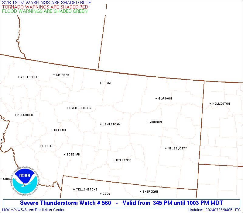
Watch 560 Status Report Messages:
STATUS REPORT #3 ON WW 560
VALID 260225Z - 260340Z
SEVERE WEATHER THREAT CONTINUES RIGHT OF A LINE FROM 70 NNE BIL
TO 70 NNW GGW.
..HALBERT..07/26/24
ATTN...WFO...TFX...GGW...
&&
STATUS REPORT FOR WS 560
SEVERE WEATHER THREAT CONTINUES FOR THE FOLLOWING AREAS
MTC019-033-105-260340-
MT
. MONTANA COUNTIES INCLUDED ARE
DANIELS GARFIELD VALLEY
$$
THE WATCH STATUS MESSAGE IS FOR GUIDANCE PURPOSES ONLY. PLEASE
REFER TO WATCH COUNTY NOTIFICATION STATEMENTS FOR OFFICIAL
INFORMATION ON COUNTIES...INDEPENDENT CITIES AND MARINE ZONES
CLEARED FROM SEVERE THUNDERSTORM AND TORNADO WATCHES.
$$
STATUS REPORT #2 ON WW 560
VALID 260110Z - 260240Z
SEVERE WEATHER THREAT CONTINUES RIGHT OF A LINE FROM 55 N BIL TO
80 NW GGW.
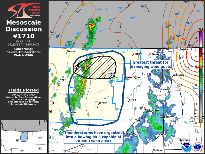
FOR ADDITIONAL INFORMATION SEE MESOSCALE DISCUSSION 1710
..HALBERT..07/26/24
ATTN...WFO...TFX...GGW...
&&
STATUS REPORT FOR WS 560
SEVERE WEATHER THREAT CONTINUES FOR THE FOLLOWING AREAS
MTC019-033-069-071-105-260240-
MT
. MONTANA COUNTIES INCLUDED ARE
DANIELS GARFIELD PETROLEUM
PHILLIPS VALLEY
$$
THE WATCH STATUS MESSAGE IS FOR GUIDANCE PURPOSES ONLY. PLEASE
REFER TO WATCH COUNTY NOTIFICATION STATEMENTS FOR OFFICIAL
INFORMATION ON COUNTIES...INDEPENDENT CITIES AND MARINE ZONES
CLEARED FROM SEVERE THUNDERSTORM AND TORNADO WATCHES.
$$
STATUS REPORT #1 ON WW 560
VALID 252340Z - 260040Z
SEVERE WEATHER THREAT CONTINUES RIGHT OF A LINE FROM 15 NNE 3HT
TO 45 NNE HVR.
..HALBERT..07/25/24
ATTN...WFO...TFX...GGW...
&&
STATUS REPORT FOR WS 560
SEVERE WEATHER THREAT CONTINUES FOR THE FOLLOWING AREAS
MTC005-019-027-033-069-071-105-260040-
MT
. MONTANA COUNTIES INCLUDED ARE
BLAINE DANIELS FERGUS
GARFIELD PETROLEUM PHILLIPS
VALLEY
$$
THE WATCH STATUS MESSAGE IS FOR GUIDANCE PURPOSES ONLY. PLEASE
REFER TO WATCH COUNTY NOTIFICATION STATEMENTS FOR OFFICIAL
INFORMATION ON COUNTIES...INDEPENDENT CITIES AND MARINE ZONES
CLEARED FROM SEVERE THUNDERSTORM AND TORNADO WATCHES.
$$
Note:
Click for Complete Product Text.
Tornadoes
Probability of 2 or more tornadoes
|
Low (<5%)
|
Probability of 1 or more strong (EF2-EF5) tornadoes
|
Low (<2%)
|
Wind
Probability of 10 or more severe wind events
|
Mod (60%)
|
Probability of 1 or more wind events > 65 knots
|
Mod (30%)
|
Hail
Probability of 10 or more severe hail events
|
Low (20%)
|
Probability of 1 or more hailstones > 2 inches
|
Low (<5%)
|
Combined Severe Hail/Wind
Probability of 6 or more combined severe hail/wind events
|
High (80%)
|
For each watch, probabilities for particular events inside the watch
(listed above in each table) are determined by the issuing forecaster.
The "Low" category contains probability values ranging from less than 2%
to 20% (EF2-EF5 tornadoes), less than 5% to 20% (all other probabilities),
"Moderate" from 30% to 60%, and "High" from 70% to greater than 95%.
High values are bolded and lighter in color to provide awareness of
an increased threat for a particular event.


 @NWSSPC