|
| Mesoscale Discussion 2105 |
|
< Previous MD Next MD >
|

|
   Mesoscale Discussion 2105
   NWS Storm Prediction Center Norman OK
   0552 PM CDT Tue Sep 24 2024

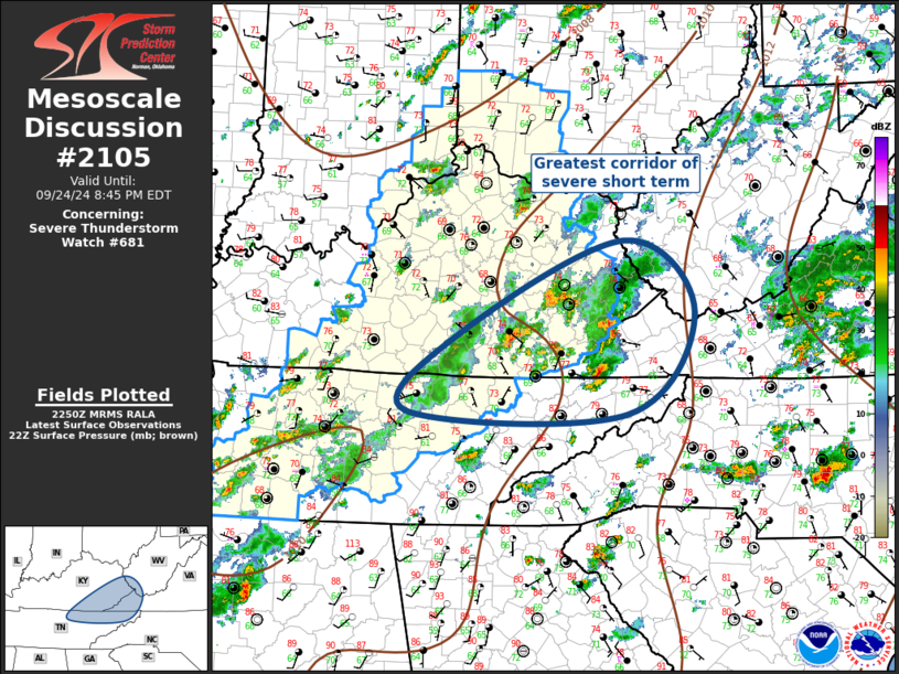
   Areas affected...Eastern KY/TN into southwest WV/western VA

   Concerning...Severe Thunderstorm Watch 681...

   Valid 242252Z - 250045Z

   The severe weather threat for Severe Thunderstorm Watch 681
   continues.

   SUMMARY...Some hail/wind threat continues with scattered storms this
   evening.

   DISCUSSION...Short-wave trough is ejecting across the OH Valley
   early this evening and scattered strong/severe convection continues
   within the warm-advection zone, well ahead of the front. Over the
   last few hours, greatest concentration of robust, long-lived
   updrafts/supercells is beneath the strongest mid-level flow across
   eastern KY/northeast TN. Radar data suggests at least 4-6
   supercells, extending 50mi either side of the TN/KY border, moving
   east-northeast toward western VA/southwest WV. However, air mass is
   notably less buoyant downstream and these updrafts will encounter
   increasingly hostile environment across the higher terrain and
   points east. Until then, hail/wind threat will continue with these
   storms.

   ..Darrow.. 09/24/2024

   ...Please see www.spc.noaa.gov for graphic product...

   ATTN...WFO...RNK...RLX...MRX...JKL...LMK...OHX...

   LAT...LON   37058475 38078251 37298155 36198246 36218544 37058475
|
|
Top/All Mesoscale Discussions/Forecast Products/Home
|
|


