|
| Mesoscale Discussion 2009 |
|
< Previous MD Next MD >
|

|
   Mesoscale Discussion 2009
   NWS Storm Prediction Center Norman OK
   1111 PM CDT Mon Aug 26 2024

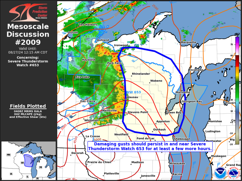
   Areas affected...portions of central into eastern Wisconsin and
   western Upper Michigan

   Concerning...Severe Thunderstorm Watch 653...

   Valid 270411Z - 270515Z

   The severe weather threat for Severe Thunderstorm Watch 653
   continues.

   SUMMARY...The severe threat continues in and near Severe
   Thunderstorm Watch 653. Damaging wind gusts are the main threat, and
   this threat should persist for at least a few more hours.

   DISCUSSION...A mature MCS with a history of strong, damaging gusts
   continues to progress eastward over central WI. Given nocturnal
   cooling, temperatures are dropping into the 75-80F range, suggesting
   that MLCINH should be on the increase ahead of the MCS. While this
   may dampen wind damage potential to some degree, at least some
   threat for damaging gusts should continue for at least a few more
   hours given 3000-4000 J/kg MLCAPE preceding the line.

   ..Squitieri.. 08/27/2024

   ...Please see www.spc.noaa.gov for graphic product...

   ATTN...WFO...MQT...GRB...MKX...DLH...ARX...

   LAT...LON   46178996 46448979 46458927 46348845 46108776 45648732
               44978720 44408728 43998750 43908797 43938859 44018925
               44098958 44318974 44658968 44928962 45538968 46178996
|
|
Top/All Mesoscale Discussions/Forecast Products/Home
|
|


