|
| Mesoscale Discussion 2000 |
|
< Previous MD Next MD >
|
|
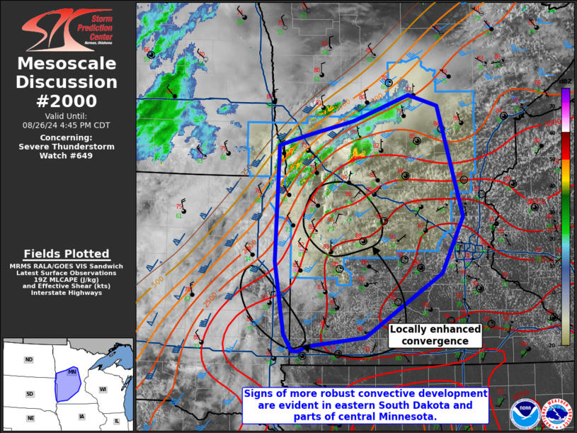
   Mesoscale Discussion 2000
   NWS Storm Prediction Center Norman OK
   0243 PM CDT Mon Aug 26 2024

   Areas affected...Far eastern South Dakota into Central/Southwest
   Minnesota

   Concerning...Severe Thunderstorm Watch 649...

   Valid 261943Z - 262145Z

   The severe weather threat for Severe Thunderstorm Watch 649
   continues.

   SUMMARY...Potential for large/very-large (2+ inches) hail and severe
   winds (some 75+ mph) will increase this afternoon into the evening,
   especially for parts of central/southern Minnesota.

   DISCUSSION...A storm within the buoyancy gradient has increased in
   intensity over the last 30 minutes. Additional development appears
   likely to its immediate south-southwest. Potential for large and
   severe winds are expected to increase this afternoon. Of additional
   concern are towering cumulus starting to develop in west-central
   Minnesota and far eastern South Dakota. Short-term guidance from the
   HRRR and the latest MPAS runs suggest that one or both of these
   areas could see storms develop within the next 1-3 hours. These
   storms are in a more favorable thermodynamic environment than storms
   farther north. Large to very-large (2+ inches) hail and severe winds
   (some 75+ mph) would be possible. The exact evolution of these
   storms remains a point of uncertainty. Most guidance suggests that
   storms could congeal into an MCS where severe winds would become a
   greater threat as activity moves east.

   ..Wendt/Guyer.. 08/26/2024

   ...Please see www.spc.noaa.gov for graphic product...

   ATTN...WFO...DLH...MPX...FGF...FSD...ABR...

   LAT...LON   46659530 46999428 46849376 45429329 44699369 43869508
               43749616 43679628 43689642 43909656 44839673 46349668
               46479616 46659530
|
|
Top/All Mesoscale Discussions/Forecast Products/Home
|
|


 @NWSSPC