|
| Mesoscale Discussion 1992 |
|
< Previous MD Next MD >
|

|
   Mesoscale Discussion 1992
   NWS Storm Prediction Center Norman OK
   1050 PM CDT Sun Aug 25 2024

   Areas affected...Northeast SD

   Concerning...Severe Thunderstorm Watch 647...

   Valid 260350Z - 260515Z

   The severe weather threat for Severe Thunderstorm Watch 647
   continues.

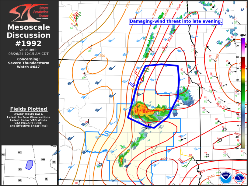
   SUMMARY...A localized damaging-wind threat may spread into northeast
   South Dakota.

   DISCUSSION...Persistent convection has evolved into a small
   outflow-driven cluster moving across east-central SD, with some
   increase in storm intensity and inbound radar velocities from KABR
   recently noted. This cluster may continue to spread
   north-northeastward, within a corridor of deeper low-level moisture,
   stronger MLCAPE, and somewhat weaker MLCINH (as noted per recent RAP
   analyses). Localized severe gusts may accompany this cluster through
   late evening as it moves into northeast SD. Observational trends
   will be monitored regarding the need for local watch expansion, if
   this cluster remains organized to the edge of WW 647.

   ..Dean.. 08/26/2024

   ...Please see www.spc.noaa.gov for graphic product...

   ATTN...WFO...FSD...ABR...

   LAT...LON   44569892 45489857 45839833 45869777 45829720 45489715
               45079720 44569756 44309803 44359830 44569892
|
|
Top/All Mesoscale Discussions/Forecast Products/Home
|
|


