|
| Mesoscale Discussion 1755 |
|
< Previous MD Next MD >
|

|
   Mesoscale Discussion 1755
   NWS Storm Prediction Center Norman OK
   0709 PM CDT Tue Jul 30 2024

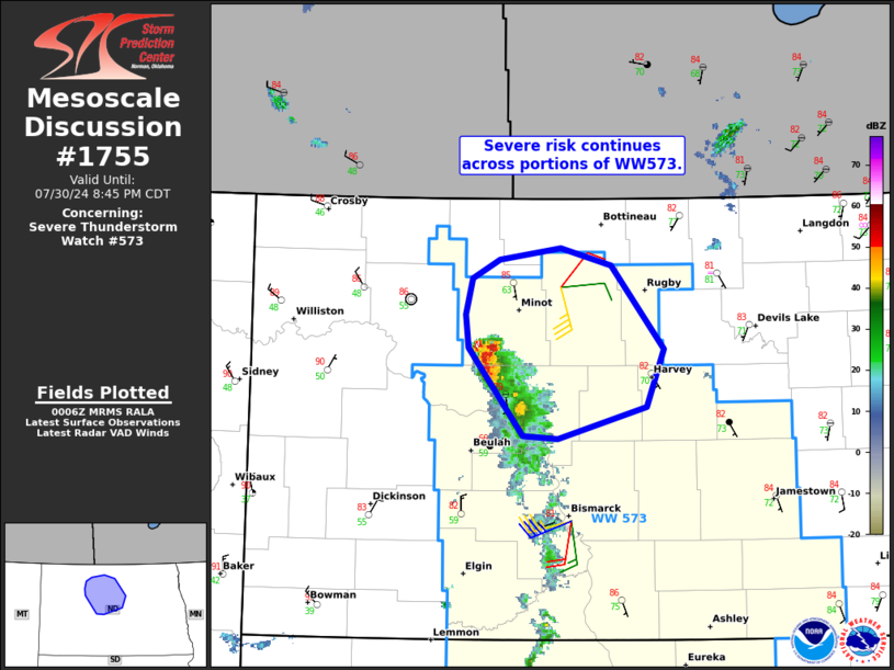
   Areas affected...Portions of north-central North Dakota

   Concerning...Severe Thunderstorm Watch 573...

   Valid 310009Z - 310145Z

   The severe weather threat for Severe Thunderstorm Watch 573
   continues.

   SUMMARY...The severe risk continues across portions of Severe
   Thunderstorm Watch 573 in north-central North Dakota. The main
   concern is severe wind gusts and isolated instances of large hail.

   DISCUSSION...Latest radar data from KMBX shows a loosely organized
   cluster/line of storms tracking east-northeastward across portions
   of north-central North Dakota. Around 30-40 kt of 0-6 km shear (per
   KMBX/KBIS VWP data) oriented perpendicular to the loosely organized
   cold pool and moderately unstable surface-based inflow should
   continue to support severe gusts (generally up to 70 mph) and
   instances of large hail with east-northeastward extent.

   ..Weinman.. 07/31/2024

   ...Please see www.spc.noaa.gov for graphic product...

   ATTN...WFO...FGF...BIS...

   LAT...LON   47360125 47960180 48200184 48450176 48580148 48660086
               48530034 47959979 47569998 47340089 47360125
|
|
Top/All Mesoscale Discussions/Forecast Products/Home
|
|


