|
| Mesoscale Discussion 1754 |
|
< Previous MD Next MD >
|

|
   Mesoscale Discussion 1754
   NWS Storm Prediction Center Norman OK
   0651 PM CDT Tue Jul 30 2024

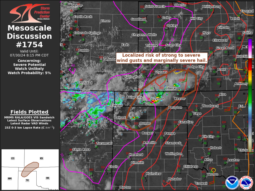
   Areas affected...Portions of the Texas and Oklahoma Panhandles into
   far southwest Kansas

   Concerning...Severe potential...Watch unlikely

   Valid 302351Z - 310115Z

   Probability of Watch Issuance...5 percent

   SUMMARY...An isolated strong to severe storm or two cannot be ruled
   out across portions of the TX/OK Panhandles into far southwest KS
   into this evening.

   DISCUSSION...Isolated thunderstorms are evolving along/immediately
   ahead of a lee trough/dryline extending across the TX/OK Panhandles
   into far southwest KS. Theses storms are in an environment
   characterized by surface temperatures in the low 100s F and
   dewpoints in the lower 60s. While vertical winds shear is not
   particularly strong (around 20-25 kt effective shear), the
   well-mixed boundary layer and somewhat focused mesoscale ascent
   could support an isolated strong/severe wind gust and perhaps
   marginally severe hail with any longer-lived storms. The risk
   appears too localized for a watch consideration.

   ..Weinman/Hart.. 07/30/2024

   ...Please see www.spc.noaa.gov for graphic product...

   ATTN...WFO...OUN...DDC...AMA...

   LAT...LON   36430237 37090186 37420129 37730048 37709989 37529960
               37049965 36660049 36280107 35850158 35700198 35730227
               35920253 36140248 36430237
|
|
Top/All Mesoscale Discussions/Forecast Products/Home
|
|


