|
| Mesoscale Discussion 1735 |
|
< Previous MD Next MD >
|

|
   Mesoscale Discussion 1735
   NWS Storm Prediction Center Norman OK
   1123 PM CDT Mon Jul 29 2024

   Areas affected...southeastern North Dakota...northeastern South
   Dakota...west central Minnesota

   Concerning...Severe Thunderstorm Watch 564...

   Valid 300423Z - 300630Z

   The severe weather threat for Severe Thunderstorm Watch 564
   continues.

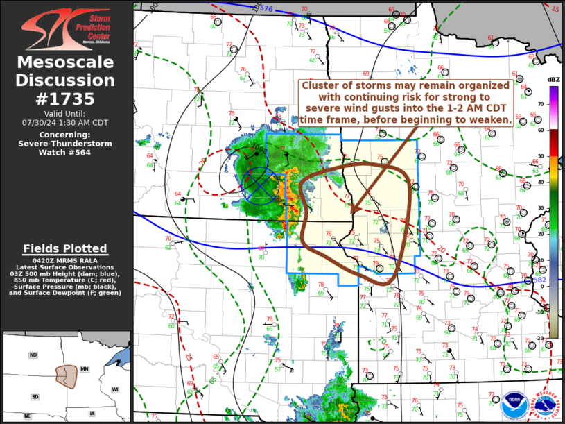
   SUMMARY...An organized cluster of thunderstorms with strong to
   occasionally severe wind gusts likely will be maintained at least
   into the 1-2 AM CDT time frame, before beginning to weaken.

   DISCUSSION...The ongoing cluster of storms is maintaining
   organization, with a modest surface cold pool including 2 hourly
   pressure rises around 2 mb and a still relatively well-defined MCV
   progressing eastward to the southeast of Jamestown.  Eastward
   propagation of the cold pool has been around 35-40 kt, resulting in
   strong easterly inflow of moist boundary-layer air characterized by
   CAPE on the order of 2000+ J/kg.  As the gust front passes east of
   the Minnesota state border between Ortonville MN and Fargo ND by
   around 0530Z, inflow may begin to become less moist and unstable,
   and more substantive weakening trends may ensue.  Until then,
   though, strong to occasionally severe gusts probably will be
   maintained.

   ..Kerr.. 07/30/2024

   ...Please see www.spc.noaa.gov for graphic product...

   ATTN...WFO...MPX...FGF...ABR...

   LAT...LON   46519768 46739696 46789610 46489535 45089571 45149645
               45419715 45639764 46089756 46519768
|
|
Top/All Mesoscale Discussions/Forecast Products/Home
|
|


