|
| Mesoscale Discussion 1736 |
|
< Previous MD Next MD >
|
|
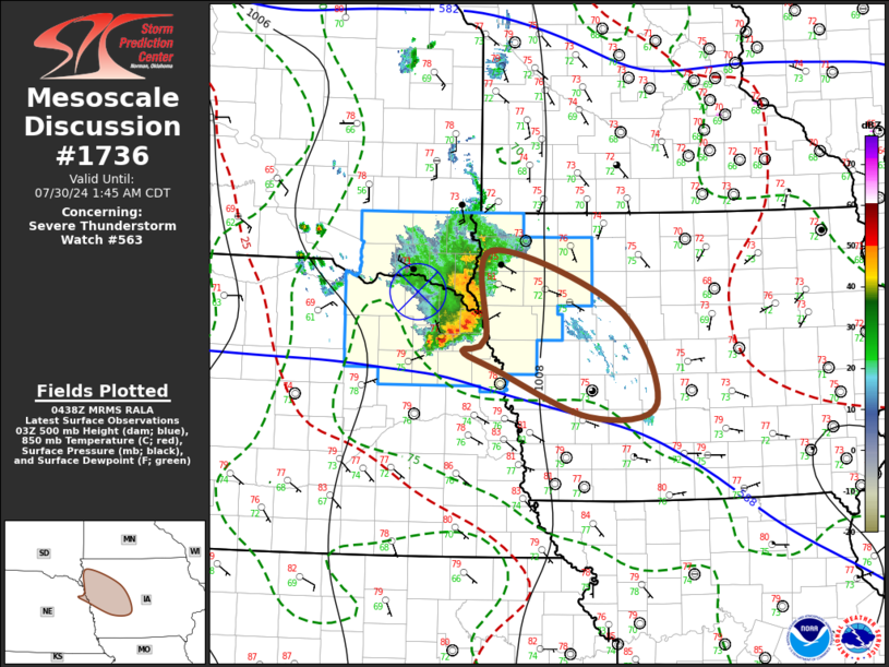
   Mesoscale Discussion 1736
   NWS Storm Prediction Center Norman OK
   1141 PM CDT Mon Jul 29 2024

   Areas affected...parts of northwest/west central Iowa and adjacent
   northeastern Nebraska

   Concerning...Severe Thunderstorm Watch 563...

   Valid 300441Z - 300645Z

   The severe weather threat for Severe Thunderstorm Watch 563
   continues.

   SUMMARY...A compact, but well-organized cluster of storms is being
   maintained across the Sioux City area, and it possible that this
   activity may continue to pose a risk for strong to severe wind gusts
   for at least a few more hours.

   DISCUSSION...Despite the presence of strong lower/mid-tropospheric
   inhibition, convection has become better organized in a compact
   cluster now propagating across and east-southeast of the Sioux City
   area.  The associated surface cold pool included 2 hourly pressure
   rises of 5.7 mb at Yankton during the 04Z obs, and a small MCV has
   become well-defined.  Given the 40 kt forward propagation of this
   cluster, strong low-level inflow of moist boundary-layer air
   characterized by CAPE in excess in excess of 2000 J/kg might still
   continue to overcome the mid-level inhibition at least a few more
   hours.

   ..Kerr.. 07/30/2024

   ...Please see www.spc.noaa.gov for graphic product...

   ATTN...WFO...DMX...FSD...OAX...

   LAT...LON   43129630 42539457 41559404 41439495 41919624 42109669
               42229636 43129630
|
|
Top/All Mesoscale Discussions/Forecast Products/Home
|
|


 @NWSSPC