|
| Mesoscale Discussion 223 |
|
< Previous MD Next MD >
|
|
Mesoscale Discussion 0223
NWS Storm Prediction Center Norman OK
0831 AM CDT Sun Mar 16 2025
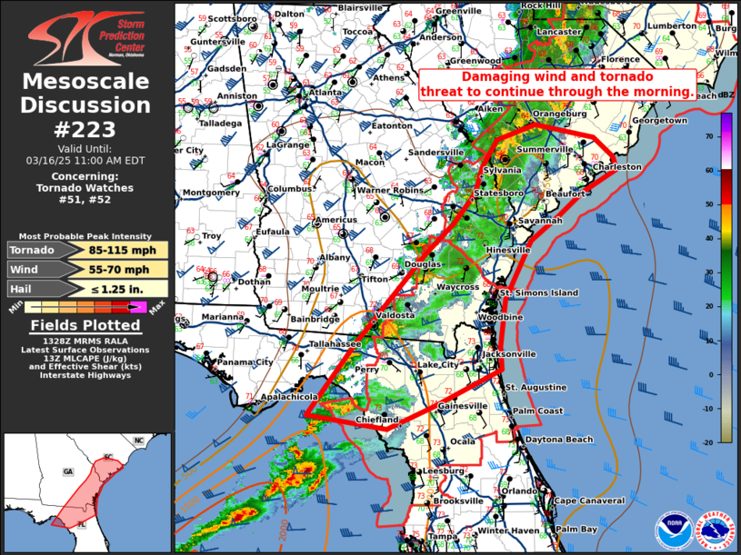
Areas affected...Eastern Georgia...far southern South Carolina...and
northern Florida
Concerning...Tornado Watch 51...52...
Valid 161331Z - 161500Z
The severe weather threat for Tornado Watch 51, 52 continues.
SUMMARY...Damaging wind and tornado threat to continue through the
morning.
DISCUSSION...A line of storms with embedded supercells continues to
move east across the Southeast. Instability is mostly weak (250-500
J/kg MLCAPE) ahead of this line with slightly better instability
across north Florida where upper 60s dewpoints are present. This
line of storms has now moved well ahead of the synoptic cold front.
Therefore, given the weakening forcing, the strongest storms will
likely be in north Florida this morning. However, very strong
low-level shear is present ahead of the entire line of storms with
over 400 m2/s2 0-1km SRH per CLX VWP where a 60 knot low-level jet
is present. Given the strong low-level shear, damaging wind gusts
and brief tornadoes will be possible through the morning despite the
relatively weak instability and forcing.
..Bentley/Gleason.. 03/16/2025
...Please see www.spc.noaa.gov for graphic product...
ATTN...WFO...CHS...CAE...TBW...JAX...FFC...TAE...
LAT...LON 29598426 30548354 31738248 32138206 32538172 32868161
33228139 33438078 33247988 32997957 32827953 32528005
32228044 31898086 31138126 30518134 30208132 29728233
29418306 29598426
|
|
Top/All Mesoscale Discussions/Forecast Products/Home
|
|


 @NWSSPC