|
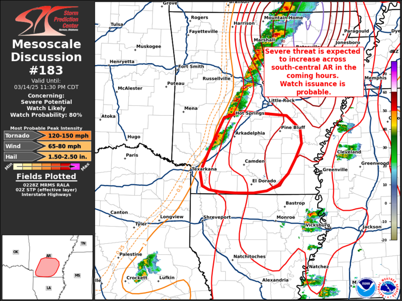
| Mesoscale Discussion 183 |
|
< Previous MD Next MD >
|

|
   Mesoscale Discussion 0183
   NWS Storm Prediction Center Norman OK
   0930 PM CDT Fri Mar 14 2025

   Areas affected...South-central Arkansas

   Concerning...Severe potential...Watch likely

   Valid 150230Z - 150430Z

   Probability of Watch Issuance...80 percent

   SUMMARY...Supercell development across south-central Arkansas
   appears probable in the coming hours as a dryline shifts east. Watch
   issuance will likely be needed in this region to address this
   threat.

   DISCUSSION...KLZK and GOES IR imagery show thunderstorm development
   southward along a dryline from the Hot Spring, AR region southward
   towards Texarkana. 02 UTC upper air analyses suggest that low to
   mid-level winds are not quite as strong compared to northern AR;
   however, a strengthening low-level jet sampled by KLZK and KSHV VWPs
   is supporting 0-1 km SRH on the order of 200-300 m2/s2. Improving
   low-level kinematics combined with slightly better surface
   moisture/MLCAPE is yielding STP values on the order of 2-4, which
   implies a robust tornado environment is in place downstream of the
   developing convection. Discrete to semi-discrete supercells
   migrating into this air mass may be capable of very large hail (1.5
   to 2.0 inches in diameter) and potentially significant (EF-2+)
   tornadoes. Watch issuance will likely be needed in the near term to
   address this potential.

   ..Moore/Mosier.. 03/15/2025

   ...Please see www.spc.noaa.gov for graphic product...

   ATTN...WFO...JAN...LZK...SHV...

   LAT...LON   33439383 33849363 34489329 34599284 34519185 34259154
               33989151 33689166 33419182 33199205 33089230 33049260
               33049302 33069338 33109362 33179377 33439383
|
|
Top/All Mesoscale Discussions/Forecast Products/Home
|
|


