|
| Mesoscale Discussion 147 |
|
< Previous MD Next MD >
|

|
   Mesoscale Discussion 0147
   NWS Storm Prediction Center Norman OK
   0750 AM CST Wed Mar 05 2025

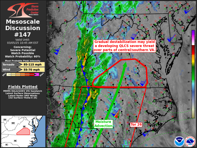
   Areas affected...south-central Virginia

   Concerning...Severe potential...Watch possible

   Valid 051350Z - 051545Z

   Probability of Watch Issuance...60 percent

   SUMMARY...A risk of damaging gusts or a brief tornado will gradually
   increase across parts of southern Virginia. A watch may eventually
   be needed.

   DISCUSSION...A strongly forced low-topped convective line continues
   to push east across western VA and NC, with a rather wide region of
   rain as well. Instability is weak but shear is quite strong. As
   persistent southerly winds bring greater theta-e into the region,
   temperatures rising into the 60s should eventually yield sufficient
   low-level buoyancy to support strong gusts or a brief QLCS tornado.
   Prior to any substantial boundary-layer destabilization, any severe
   risk will likely remain tied to the forced line.

   ..Jewell/Smith.. 03/05/2025

   ...Please see www.spc.noaa.gov for graphic product...

   ATTN...WFO...AKQ...RNK...

   LAT...LON   36897984 37757841 37797764 37417705 36747700 36577714
               36577963 36597987 36707994 36897984
|
|
Top/All Mesoscale Discussions/Forecast Products/Home
|
|


