|
| Mesoscale Discussion 148 |
|
< Previous MD Next MD >
|

|
   Mesoscale Discussion 0148
   NWS Storm Prediction Center Norman OK
   0841 AM CST Wed Mar 05 2025

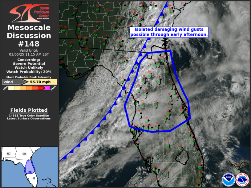
   Areas affected...central and northern Florida

   Concerning...Severe potential...Watch unlikely

   Valid 051441Z - 051615Z

   Probability of Watch Issuance...20 percent

   SUMMARY...Isolated damaging wind gusts are possible through early
   afternoon across central and northern Florida.

   DISCUSSION...A remnant squall line is moving across northern Florida
   this morning. Ahead of this squall line, mid to upper 60s dewpoints
   are present across the Florida Peninsula. Currently this airmass
   remains capped, but breaks in the clouds should allow sufficient
   heating for an uncapped, moderately unstable environment by later
   this afternoon. The 12Z JAX RAOB sampled a veering wind profile
   favorable for storm organization including supercells. However,
   forcing will be the primary limiting factor to a greater severe
   weather threat. Convergence along the squall line is weak across
   north Florida. While some height falls will overspread the region
   through the day, the primary differential vorticity advection
   corridor will be focused in the Carolinas and Mid-Atlantic.
   Therefore, a few strong to severe storms may be possible, but the
   threat should remain too isolated for a watch.

   ..Bentley/Mosier.. 03/05/2025

   ...Please see www.spc.noaa.gov for graphic product...

   ATTN...WFO...MLB...TBW...JAX...

   LAT...LON   28728309 29708265 30258249 30558218 30638128 30338121
               29718104 29188076 28878060 28298052 27858130 27838203
               27938261 28028287 28728309
|
|
Top/All Mesoscale Discussions/Forecast Products/Home
|
|


