|
| Mesoscale Discussion 89 |
|
< Previous MD Next MD >
|
|
Mesoscale Discussion 0089
NWS Storm Prediction Center Norman OK
0229 PM CST Wed Feb 12 2025
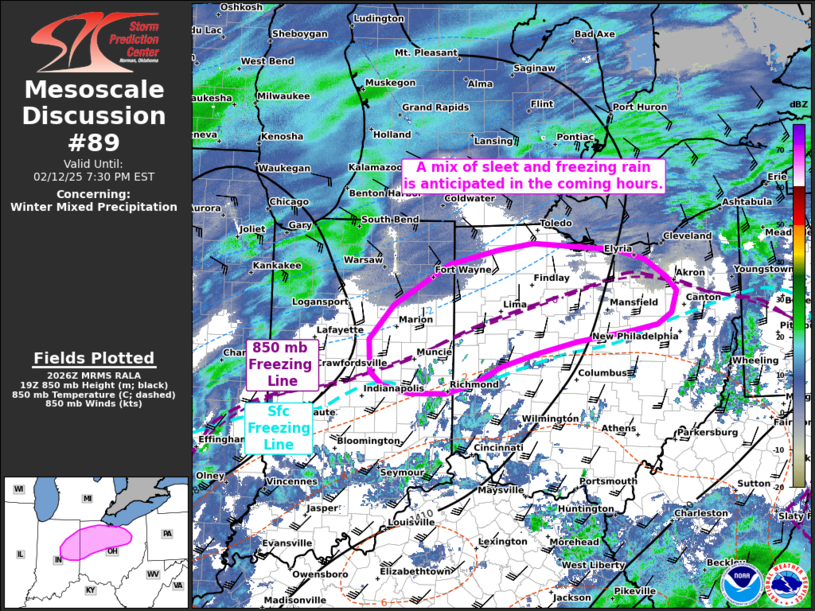
Areas affected...Eastern Indiana into northwest Ohio
Concerning...Winter mixed precipitation
Valid 122029Z - 130030Z
SUMMARY...A mix of sleet and freezing rain is expected to overspread
eastern Indiana and northwest Ohio over the next several hours.
Freezing rain rates up to 0.03-0.05 inch/hour are possible.
DISCUSSION...Precipitation associated with the warm advection branch
of a deepening mid-level wave is beginning to overspread parts of
central to eastern IN and southwest OH where surface temperatures
remain near or below freezing. Recent upper-air analysis and
forecast soundings show a weak warm layer aloft at around 850 mb
atop of sub-freezing surface temperatures that should support some
melting/re-freezing of hydrometeors. The weak warm nose will likely
initially support a mix of sleet and freezing rain within a narrow
swath from eastern IN into west/northwest OH where there is
favorable overlap of sub-freezing surface temperatures and warm
temperatures aloft. With time, continued warming near the 850 mb
level should promote a gradual transition to primarily freezing rain
through late afternoon/early evening. Freezing rain rates between
0.02 to 0.05 in/hour appear probable based on recent high-res
guidance that has captured surface temperature trends well.
..Moore.. 02/12/2025
...Please see www.spc.noaa.gov for graphic product...
ATTN...WFO...CLE...ILN...IWX...IND...
LAT...LON 40958148 40708156 40588177 40518214 40398297 40268354
40108408 39918451 39808490 39798545 39888585 40048604
40408605 40808569 41268487 41428415 41508361 41478294
41428237 41318194 41118162 40958148
|
|
Top/All Mesoscale Discussions/Forecast Products/Home
|
|


 @NWSSPC