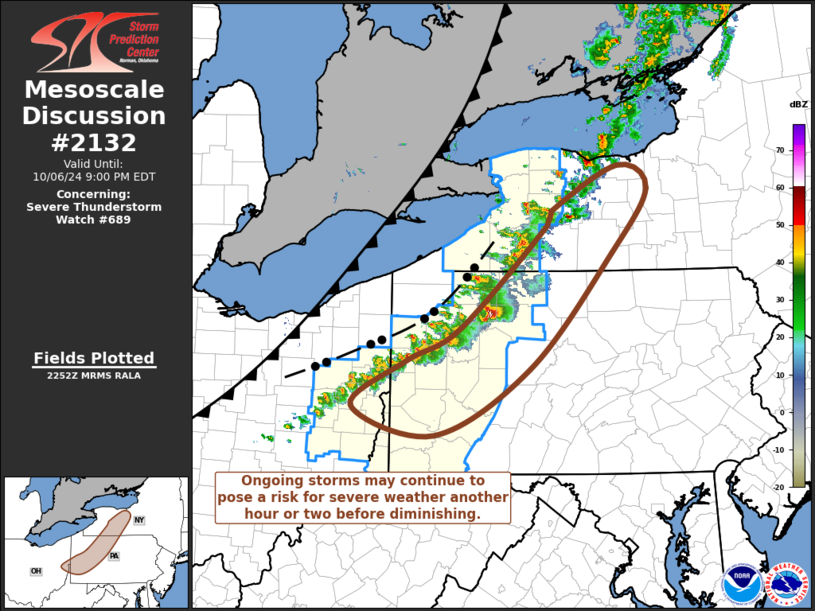
   Mesoscale Discussion 2132
   NWS Storm Prediction Center Norman OK
   0554 PM CDT Sun Oct 06 2024

   Areas affected...parts of western New York State and western
   Pennsylvania

   Concerning...Severe Thunderstorm Watch 689...

   Valid 062254Z - 070100Z

   The severe weather threat for Severe Thunderstorm Watch 689
   continues.

   SUMMARY...A couple of supercell structures will continue to spread
   toward the Allegheny Mountains of west central Pennsylvania, but
   probably will begin to weaken toward 8-10 PM EDT.  Although some
   risk for severe weather may spread east of the current severe
   weather watch area, a new severe weather watch may not be needed.

   DISCUSSION...An initial, perhaps convectively enhanced, surge of
   cool air southeast of Lake Erie is already beginning to stabilize
   the narrow pre-cold frontal instability axis now near and southeast
   of the lower Great Lakes region.  The east-southeastward movement of
   the ongoing convection across the Allegheny Plateau appears to be
   outpacing the advection of the instability axis, and it seems
   probable that storms will begin to gradually weaken through 00-02Z,
   as they acquire more stable inflow.  Until then, however, a couple
   of isolated supercell structures may continue to pose a risk for
   severe hail and locally damaging surface gusts while approaching the
   Allegheny Front.  Although wind profiles are characterized by strong
   deep-layer shear and sizable clockwise-curved low-level hodographs,
   the extent of the risk for tornadoes remains more unclear, given
   relatively low humidities in the lower/mid troposphere.

   ..Kerr.. 10/06/2024

   ...Please see www.spc.noaa.gov for graphic product...

   ATTN...WFO...BGM...BUF...CTP...PBZ...

   LAT...LON   42667813 43187712 42917668 42187723 40907844 40147987
               40488109 40998028 41347948 42507818 42667813
|


 @NWSSPC