|
| Mesoscale Discussion 2076 |
|
< Previous MD Next MD >
|

|
   Mesoscale Discussion 2076
   NWS Storm Prediction Center Norman OK
   1133 PM CDT Mon Sep 16 2024

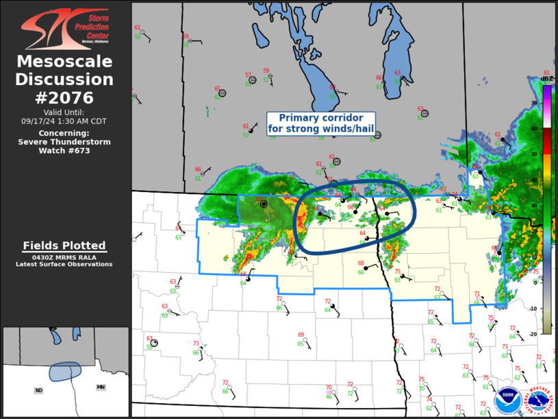
   Areas affected...Northeast North Dakota/Northwest Minnesota

   Concerning...Severe Thunderstorm Watch 673...

   Valid 170433Z - 170630Z

   The severe weather threat for Severe Thunderstorm Watch 673
   continues.

   SUMMARY...Threat for a few strong gusts, and perhaps some marginally
   severe hail, will spread across northeast North Dakota into
   northwest Minnesota.

   DISCUSSION...Long-lived MCV has tracked northeast across ND and is
   currently located near the international border over northwest
   Towner County. This feature appears partly responsible for a
   modest-sized MCS that is progressing across western portions of
   WW673. Latest surface data suggests the primary front extends from
   near Grand Forks to south of Harvey, in Wells County. Latest VWP
   data from MVX exhibits southwesterly LLJ (3km AGL) around 35kt. A
   well-defined corridor of low-level warm advection should encourage
   continued eastward propagation of the MCS across northeast ND into
   northwest MN, perhaps as early as 06z. While a few strong gusts are
   possible along the leading squall line, only marginally severe hail
   appears possible along the trailing southwestern flank. New WW is
   not currently anticipated.

   ..Darrow.. 09/17/2024

   ...Please see www.spc.noaa.gov for graphic product...

   ATTN...WFO...FGF...

   LAT...LON   49029872 49199674 48549647 48189865 49029872
|
|
Top/All Mesoscale Discussions/Forecast Products/Home
|
|


