|
| Mesoscale Discussion 2073 |
|
< Previous MD Next MD >
|
|
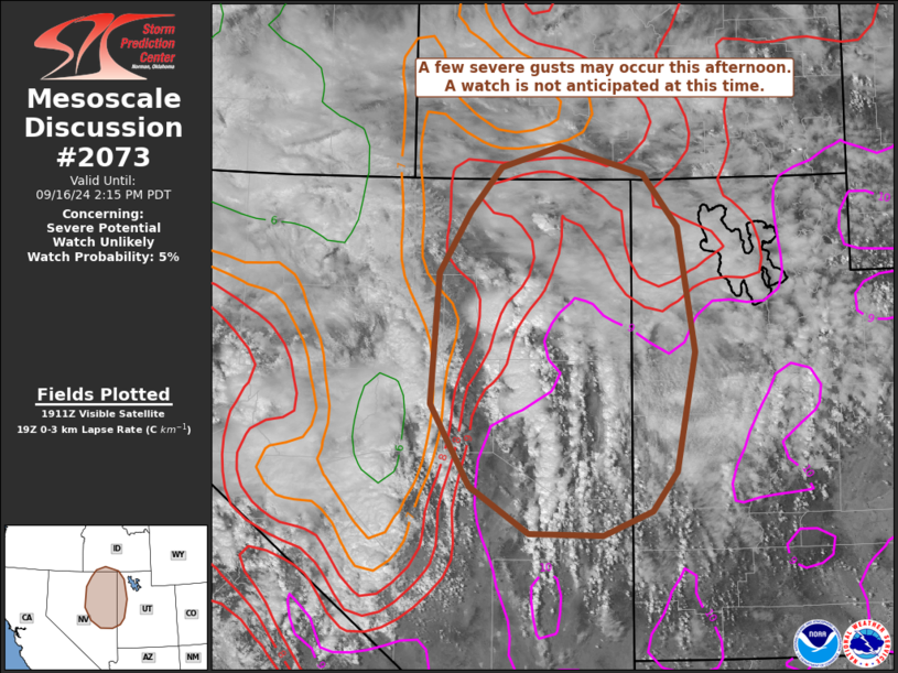
   Mesoscale Discussion 2073
   NWS Storm Prediction Center Norman OK
   0219 PM CDT Mon Sep 16 2024

   Areas affected...portions of northeastern Nevada...northwestern
   Utah...and far southern Idaho

   Concerning...Severe potential...Watch unlikely

   Valid 161919Z - 162115Z

   Probability of Watch Issuance...5 percent

   SUMMARY...A few severe gusts are possible across portions of
   northeastern Nevada, northwestern Utah, and far southern Idaho this
   afternoon. A watch is not currently anticipated.

   DISCUSSION...Thunderstorms have developed across portions of
   northeastern Nevada to the east of an expansive upper-level closed
   low centered over central California. Despite seasonably strong
   mid-level flow across the region (40-50 kts of 500 mb flow),
   deep-layer shear is not particularly impressive, with approximately
   30 kts of effective bulk shear. Additionally, some lingering cloud
   cover has resulted in slow surface destabilization across portions
   of the region. In spite of this, however, there are some areas of 9
   C/km or greater low-level lapse rates, per mesoanalysis and
   short-term RAP forecast soundings. This may result in a threat for
   severe wind gusts across the region this afternoon. Some uncertainty
   exists with respect to the northward extend of the threat due to the
   aforementioned cloud cover across portions of southern Idaho and
   northwestern Utah. Regardless, some multicell clustering is expected
   with time as storms move to the north-northeast.

   ..Supinie/Gleason.. 09/16/2024

   ...Please see www.spc.noaa.gov for graphic product...

   ATTN...WFO...SLC...PIH...VEF...BOI...LKN...

   LAT...LON   38551378 38301443 38321543 38811623 39661675 41011665
               41661624 42111581 42331501 42041387 41491341 40201319
               38951345 38551378
|
|
Top/All Mesoscale Discussions/Forecast Products/Home
|
|


 @NWSSPC