|
| Mesoscale Discussion 2066 |
|
< Previous MD Next MD >
|

|
   Mesoscale Discussion 2066
   NWS Storm Prediction Center Norman OK
   1251 PM CDT Fri Sep 13 2024

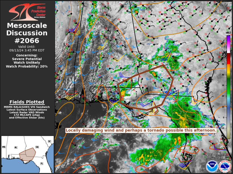
   Areas affected...Parts of the FL Panhandle into southeast
   AL/southwest GA

   Concerning...Severe potential...Watch unlikely

   Valid 131751Z - 131945Z

   Probability of Watch Issuance...20 percent

   SUMMARY...Locally damaging wind and perhaps a tornado are possible
   this afternoon.

   DISCUSSION...A small thunderstorm cluster has recently become better
   organized across the FL Panhandle. The KEVX VWP depicts backed (but
   also relatively weak) low-level flow with modest southwesterly flow
   aloft, supporting effective shear of 30-35 kt. Modest heating is
   ongoing downstream of this cluster, with MLCAPE increasing into the
   1000-1500 J/kg range. This may help to sustain the ongoing cluster,
   along with some potential for additional development into southwest
   GA with time. Locally damaging gusts will be possible, along with
   some potential for a tornado where surface flow remains backed
   through the afternoon.

   ..Dean/Gleason.. 09/13/2024

   ...Please see www.spc.noaa.gov for graphic product...

   ATTN...WFO...FFC...TAE...

   LAT...LON   31138617 31558524 32018376 31368328 30968342 30228388
               29998463 30118551 30318602 30528600 31138617
|
|
Top/All Mesoscale Discussions/Forecast Products/Home
|
|


