|
| Mesoscale Discussion 2046 |
|
< Previous MD Next MD >
|
|
Mesoscale Discussion 2046
NWS Storm Prediction Center Norman OK
0347 PM CDT Tue Sep 03 2024
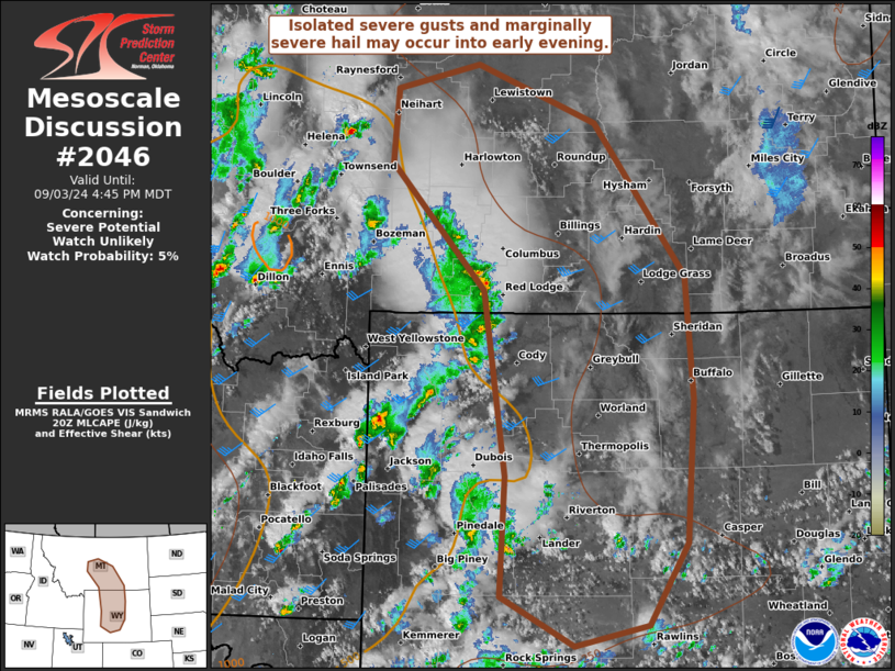
Areas affected...South-central MT and central WY
Concerning...Severe potential...Watch unlikely
Valid 032047Z - 032245Z
Probability of Watch Issuance...5 percent
SUMMARY...Isolated severe gusts and small to marginally severe hail
will be possible into early evening, as scattered thunderstorms
spread east of the higher terrain in south-central Montana to
central Wyoming.
DISCUSSION...Thunderstorm coverage has become scattered across the
northern Rockies, downstream of the smoke-filled mid-level low
gradually pivoting east over central ID. The leading convection,
exiting the Absaroka Range, should spread towards the greater
Billings area in the next couple hours. This activity should tend to
weaken over southeast MT/northeast WY as it outpaces the eastern
gradient of the weak buoyancy plume. Farther south, convection over
western WY should similarly spread into parts of the Wind River
Basin. With surface temperature-dew point spreads commonly from
40-50 F, strong to severe gusts of 55-70 mph will be the primary
hazard into early evening. This threat should remain relatively
localized and sporadic owing to weak lower-level northwesterlies
beneath 30-45 kt mid-level southwesterlies, per the Billings and
Riverton VWPs.
..Grams/Smith.. 09/03/2024
...Please see www.spc.noaa.gov for graphic product...
ATTN...WFO...CYS...BYZ...GGW...RIW...TFX...
LAT...LON 46431077 47151071 47390960 46840798 45350675 44150666
42760676 41970728 41770826 42240926 43420920 45210949
46431077
|
|
Top/All Mesoscale Discussions/Forecast Products/Home
|
|


 @NWSSPC