|
| Mesoscale Discussion 2020 |
|
< Previous MD Next MD >
|
|
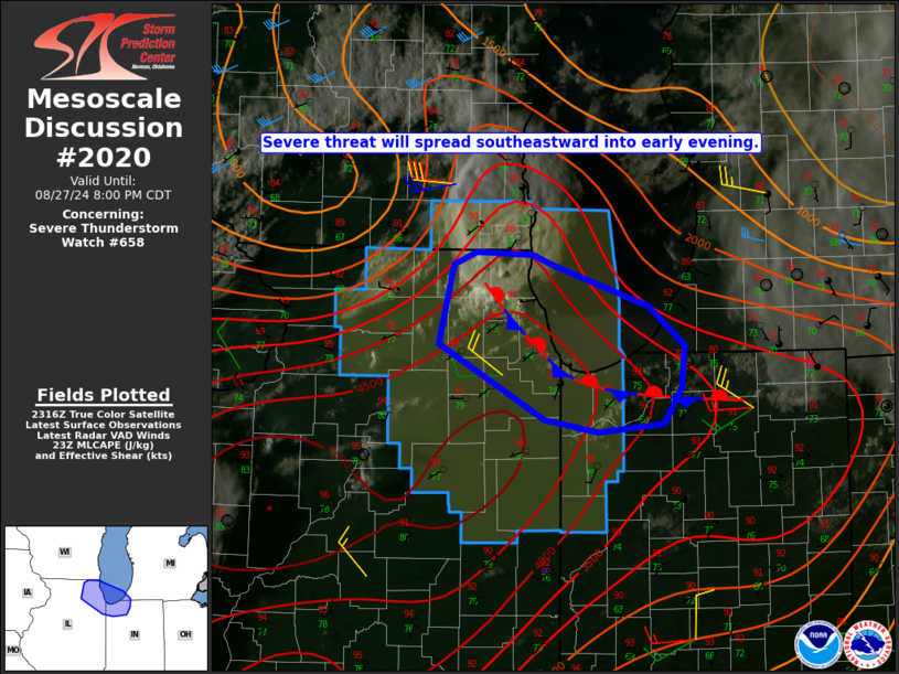
   Mesoscale Discussion 2020
   NWS Storm Prediction Center Norman OK
   0624 PM CDT Tue Aug 27 2024

   Areas affected...Northeast IL into extreme northwest IN/southwest MI

   Concerning...Severe Thunderstorm Watch 658...

   Valid 272324Z - 280100Z

   The severe weather threat for Severe Thunderstorm Watch 658
   continues.

   SUMMARY...The severe threat will spread southeastward through early
   evening.

   DISCUSSION...A supercell has developed across far northeast IL, with
   reports of severe wind gusts and hail up to golf ball size thus far.
   Large to extreme instability will continue to support vigorous
   updrafts early this evening. Deep-layer shear becomes increasingly
   modest with southward extent, but will remain locally enhanced near
   a lake-enhanced surface boundary draped northwest to southeast
   across the Chicagoland vicinity. The ongoing supercell may propagate
   southeastward near this boundary, with a continued threat of large
   hail and severe/damaging gusts.

   There is some potential for additional development near the trailing
   outflow, with increasing cumulus noted in Kane County. Depending on
   the number and proximity of storms that develop early this evening,
   some upscale growth into a southeastward-moving cluster will be
   possible with time. Downstream watch issuance is possible if a
   severe threat begins to approach northwest IN/southwest MI.

   ..Dean/Gleason.. 08/27/2024

   ...Please see www.spc.noaa.gov for graphic product...

   ATTN...WFO...IWX...LOT...

   LAT...LON   42488833 42458779 42398760 42088668 41808633 41518637
               41258654 41188716 41288767 41548817 41828869 42388855
               42488833
|
|
Top/All Mesoscale Discussions/Forecast Products/Home
|
|


 @NWSSPC