|
| Mesoscale Discussion 1969 |
|
< Previous MD Next MD >
|

|
   Mesoscale Discussion 1969
   NWS Storm Prediction Center Norman OK
   0522 PM CDT Wed Aug 21 2024

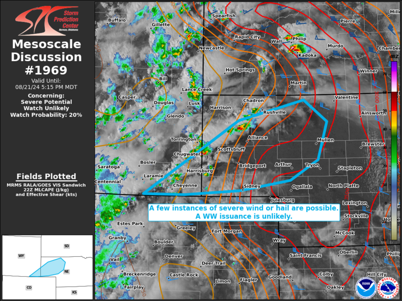
   Areas affected...portions of far southeastern Wyoming into western
   Nebraska

   Concerning...Severe potential...Watch unlikely

   Valid 212222Z - 212315Z

   Probability of Watch Issuance...20 percent

   SUMMARY...A few instances of severe wind and hail are possible
   through evening. A WW issuance is not expected given the isolated
   nature of the severe threat.

   DISCUSSION...Multicells and transient supercells have developed over
   the higher terrain, where MRMS mosaic radar imagery depicts hail
   possibly approaching severe limits in some of the stronger storm
   cores. These storms are developing amid 8.5+ C/km low- and mid-level
   lapse rates, that combined with 30+ kts of effective bulk shear (per
   22Z mesoanalysis), should support some continued storm organization
   through the remainder of the afternoon. Occasional severe gusts or
   hail are the main threats. However, given the isolated nature of the
   severe threat, a WW issuance is not currently anticipated.

   ..Squitieri/Gleason.. 08/21/2024

   ...Please see www.spc.noaa.gov for graphic product...

   ATTN...WFO...LBF...CYS...

   LAT...LON   41030555 42490309 42890135 42470075 41720099 41310173
               41120303 41030449 41030555
|
|
Top/All Mesoscale Discussions/Forecast Products/Home
|
|


