|
| Mesoscale Discussion 1962 |
|
< Previous MD Next MD >
|

|
   Mesoscale Discussion 1962
   NWS Storm Prediction Center Norman OK
   0931 PM CDT Mon Aug 19 2024

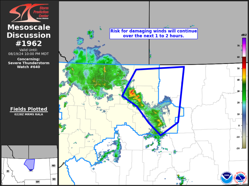
   Areas affected...north-central Montana

   Concerning...Severe Thunderstorm Watch 640...

   Valid 200231Z - 200400Z

   The severe weather threat for Severe Thunderstorm Watch 640
   continues.

   SUMMARY...Risk for locally damaging wind gusts continues across
   parts of north-central Montana, in/near WW 640.

   DISCUSSION...Latest radar loop shows that as storms have descended
   from higher elevations into a more moist/unstable airmass,
   intensification/organization of the storms into a loose banded
   structure has occurred.  The convection is moving northeastward at
   around 40 kt, and has produced wind gusts in the 50 to 60 MPH range
   over the past hour, along with small hail.  Expect risk for damaging
   wind gusts to continue locally over the next hour or so, before
   storms weaken -- and begin moving across the international border.
   This should correspond well to the currently scheduled 20/04Z
   expiration time set for WW 640.

   ..Goss.. 08/20/2024

   ...Please see www.spc.noaa.gov for graphic product...

   ATTN...WFO...BYZ...GGW...TFX...

   LAT...LON   47961130 48241110 48841063 48920826 47100859 46680943
               47091000 47631058 47961130
|
|
Top/All Mesoscale Discussions/Forecast Products/Home
|
|


