|
| Mesoscale Discussion 1947 |
|
< Previous MD Next MD >
|

|
   Mesoscale Discussion 1947
   NWS Storm Prediction Center Norman OK
   0253 PM CDT Sun Aug 18 2024

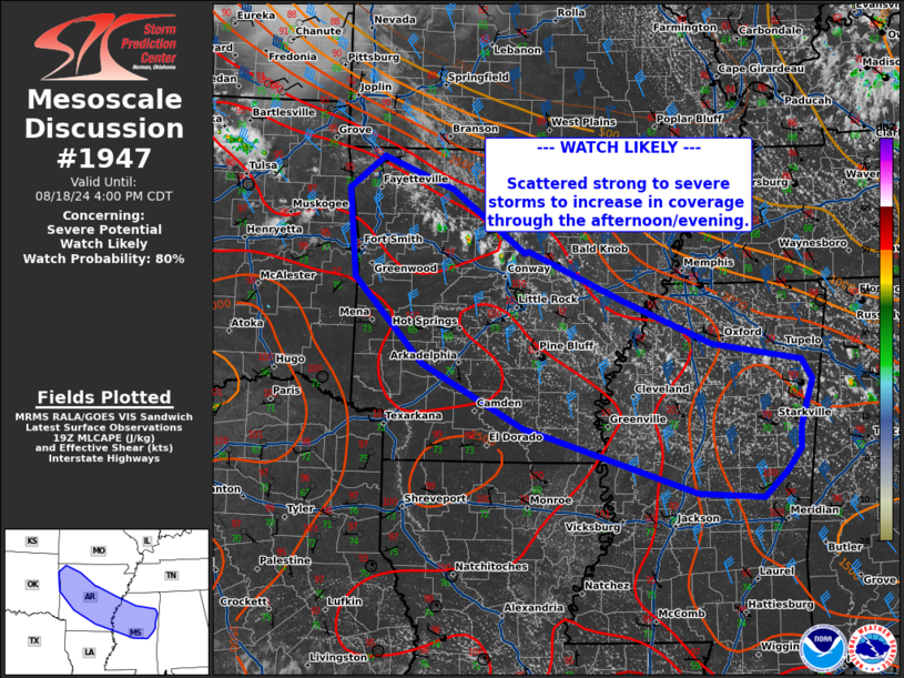
   Areas affected...central Arkansas...northern Mississippi

   Concerning...Severe potential...Watch likely

   Valid 181953Z - 182100Z

   Probability of Watch Issuance...80 percent

   SUMMARY...Scattered strong to severe thunderstorms to increase in
   coverage through the afternoon with potential for large hail and
   damaging wind.

   DISCUSSION...Thunderstorm development is likely across central
   Arkansas into northern Mississippi over the next 1-2 hours as a cold
   front sags south through time. The air mass ahead of the front is
   characterized by as sharp MLCAPE gradient around 1000-3000 J/kg with
   temperatures near 100 F and dew points in the low to mid 70s. A belt
   of deep layer shear around 40-50 kts and the moist and unstable air
   mass will support multicell clusters, capable of damaging wind and
   instances of severe hail. A watch will likely be needed for portions
   of this area to cover this threat soon.

   ..Thornton/Hart.. 08/18/2024

   ...Please see www.spc.noaa.gov for graphic product...

   ATTN...WFO...MEG...JAN...LZK...TSA...

   LAT...LON   33279179 32658985 32598899 32898866 33148849 33388848
               33918832 34128845 34318965 34799083 35359212 35349216
               36049315 36419410 36049457 35059446 34109355 33389217
               33279179
|
|
Top/All Mesoscale Discussions/Forecast Products/Home
|
|


