|
| Mesoscale Discussion 1918 |
|
< Previous MD Next MD >
|

|
   Mesoscale Discussion 1918
   NWS Storm Prediction Center Norman OK
   0119 AM CDT Fri Aug 16 2024

   Areas affected...Central IL...Far Northwest IN...Extreme Northeast
   MO

   Concerning...Severe Thunderstorm Watch 626...

   Valid 160619Z - 160815Z

   The severe weather threat for Severe Thunderstorm Watch 626
   continues.

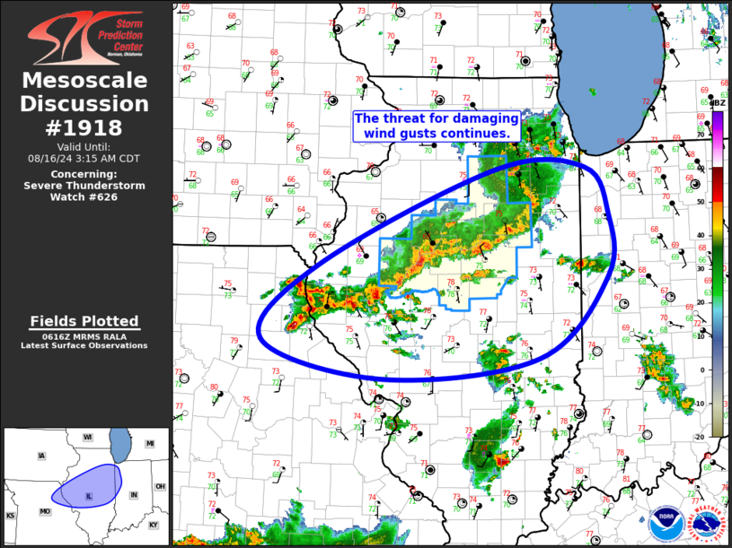
   SUMMARY...The threat for damaging wind gusts continues from far
   northeast Missouri across central Illinois into far northwest
   Indiana.

   DISCUSSION...Thunderstorm coverage within the convective cluster
   ongoing across central IL has expanded southwestward along the
   outflow into more of west-central IL and far northeast MO over the
   past hour. The airmass downstream of this new development is moist
   and buoyant, as evidenced by the more discrete storms currently
   developing ahead of the line over central IL. As such, the general
   expectation is for this newer development to persist, and perhaps
   even strengthen, as it continues eastward over the next few hours.
   Primary risk would be damaging gusts with any bowing line segments.

   Farther north, the portion of the line moving across northeast IL
   continues to move eastward at about 40 kt. Buoyancy decreases
   notably from northeast IL into northern IN, and the general
   expectation is for this portion of the line to gradually weaken.
   Even so, localized damaging gusts will remain possible, particularly
   over the next hour or so.

   ..Mosier.. 08/16/2024

   ...Please see www.spc.noaa.gov for graphic product...

   ATTN...WFO...IND...LOT...ILX...LSX...DVN...

   LAT...LON   40419131 41488875 41498746 40998712 40298713 39378813
               39159039 39589214 40419131
|
|
Top/All Mesoscale Discussions/Forecast Products/Home
|
|


