|
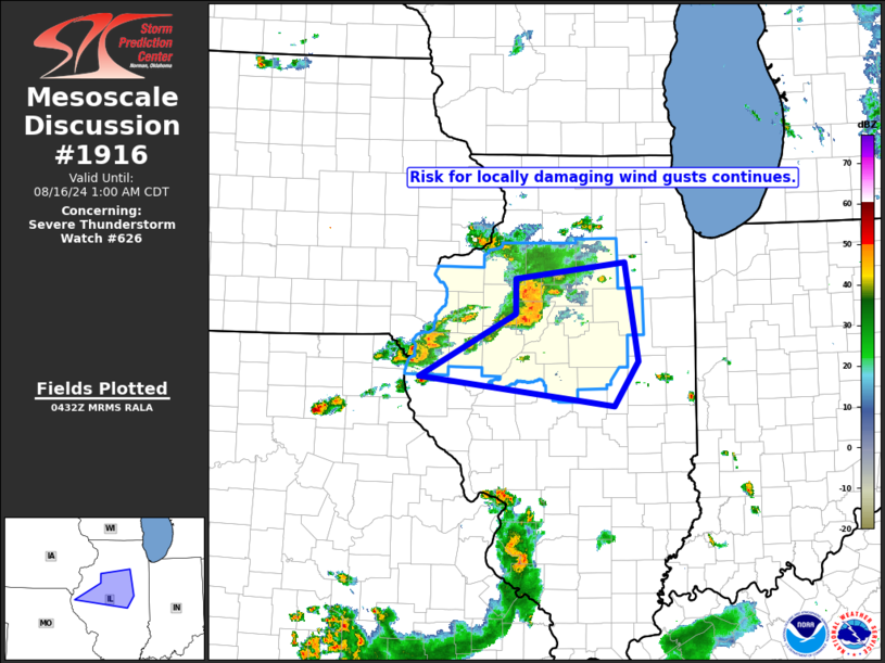
| Mesoscale Discussion 1916 |
|
< Previous MD Next MD >
|

|
   Mesoscale Discussion 1916
   NWS Storm Prediction Center Norman OK
   1134 PM CDT Thu Aug 15 2024

   Areas affected...northern Illinois

   Concerning...Severe Thunderstorm Watch 626...

   Valid 160434Z - 160600Z

   The severe weather threat for Severe Thunderstorm Watch 626
   continues.

   SUMMARY...Risk for gusty/damaging outflow winds continues across
   portions of northern Illinois.

   DISCUSSION...Latest radar loop shows a bowing cluster of
   strong/severe storms moving eastward across portions of northern
   Illinois at around 40 kt.  The strongest convection is crossing
   Stark and Peoria counties at this time, and will affect Marshall and
   Woodford Counties shortly.  The storms are currently moving through
   the axis of instability (1500 to 2000 J/kg mixed-layer CAPE per
   RAP-based objective analysis), and as such, should maintain
   intensity over the next 1 to 2 hours before eventually encountering
   a more stable/increasingly capped airmass beginning just west of the
   Indiana border.  Until then, local gusts in excess of 50 kt will
   remain possible.

   ..Goss.. 08/16/2024

   ...Please see www.spc.noaa.gov for graphic product...

   ATTN...WFO...LOT...ILX...LSX...DVN...

   LAT...LON   40179131 40838999 41218998 41378849 40338831 39878863
               40179131
|
|
Top/All Mesoscale Discussions/Forecast Products/Home
|
|


