|
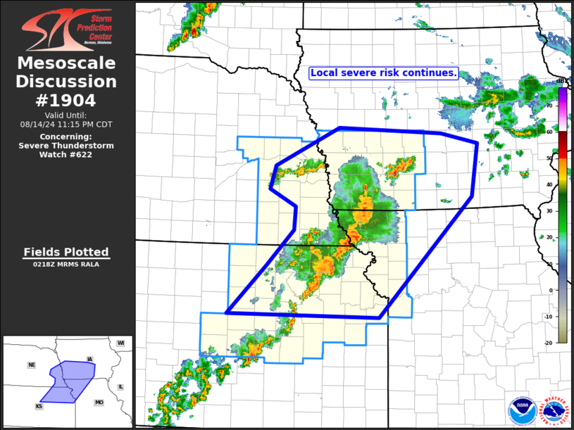
| Mesoscale Discussion 1904 |
|
< Previous MD Next MD >
|

|
   Mesoscale Discussion 1904
   NWS Storm Prediction Center Norman OK
   0920 PM CDT Wed Aug 14 2024

   Areas affected...southeastern Nebraska...northeastern
   Kansas...southwestern Iowa...and northwestern Missouri

   Concerning...Severe Thunderstorm Watch 622...

   Valid 150220Z - 150415Z

   The severe weather threat for Severe Thunderstorm Watch 622
   continues.

   SUMMARY...Local severe risk continues across the Middle Missouri
   Valley area.

   DISCUSSION...Latest radar loop shows strong/locally severe storms
   ongoing within WW 622, though gradually growing upscale into a more
   linear configuration as compared to earlier.  This has lessened the
   tornado threat that existed near the remnant outflow in northeastern
   Kansas, with risk now primarily in the form of hail, and locally
   strong/gusty winds.  As the boundary layer gradually stabilizes,
   risk for severe-caliber wind gusts should slowly lessen.  Still,
   some eventual expansion of the watch eastward may be needed a bit
   later this evening, as storms near the eastern edge of the WW.

   ..Goss.. 08/15/2024

   ...Please see www.spc.noaa.gov for graphic product...

   ATTN...WFO...DMX...EAX...OAX...TOP...ICT...

   LAT...LON   38879796 39679714 40259657 40629654 40919709 41289698
               41919562 41819344 41649267 40779281 38829479 38879796
|
|
Top/All Mesoscale Discussions/Forecast Products/Home
|
|


