|
| Mesoscale Discussion 1893 |
|
< Previous MD Next MD >
|

|
   Mesoscale Discussion 1893
   NWS Storm Prediction Center Norman OK
   0342 PM CDT Tue Aug 13 2024

   Areas affected...Portions of east-central Colorado...far southeast
   Wyoming...and the Nebraska Panhandle

   Concerning...Severe potential...Watch unlikely

   Valid 132042Z - 132245Z

   Probability of Watch Issuance...20 percent

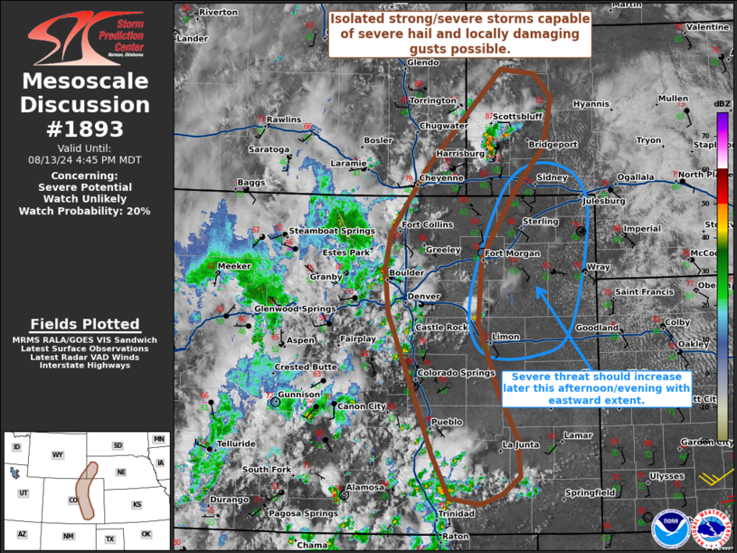
   SUMMARY...Isolated strong to severe thunderstorms capable of
   producing severe hail and locally damaging gusts are possible this
   afternoon. The severe threat should eventually increase farther east
   into this evening.

   DISCUSSION...Isolated/discrete thunderstorms are evolving
   along/immediately east of the Colorado Rockies and northward into
   the Nebraska Panhandle this afternoon, as diurnal heating continues
   to erode MLCINH along a surface wind shift/lee trough. Over the next
   couple hours, a few of these storms may intensify and pose a risk of
   isolated severe hail and locally damaging gusts -- aided by around
   30 kt of 0-6 km shear (sampled by DEN VWP and latest ACARS
   soundings). Overall, weak instability and limited large-scale
   forcing should limit the severe threat with these initial
   thunderstorms. With time, thunderstorms should increase in coverage
   and spread eastward into richer boundary-layer moisture and
   associated instability -- which should favor an increasing severe
   risk into this evening. A watch is not expected for the initial
   thunderstorms developing along/immediately east of the higher
   terrain in the near-term, though convective trends will be
   monitored.

   ..Weinman/Mosier.. 08/13/2024

   ...Please see www.spc.noaa.gov for graphic product...

   ATTN...WFO...LBF...PUB...BOU...CYS...

   LAT...LON   38650355 38140329 37670323 37460350 37340384 37410430
               37930458 38330473 39600525 40120530 40550522 41310468
               41810418 42500349 42440298 42150272 41580283 41100325
               40260381 39490387 38650355
|
|
Top/All Mesoscale Discussions/Forecast Products/Home
|
|


