|
| Mesoscale Discussion 1862 |
|
< Previous MD Next MD >
|

|
   Mesoscale Discussion 1862
   NWS Storm Prediction Center Norman OK
   1057 PM CDT Wed Aug 07 2024

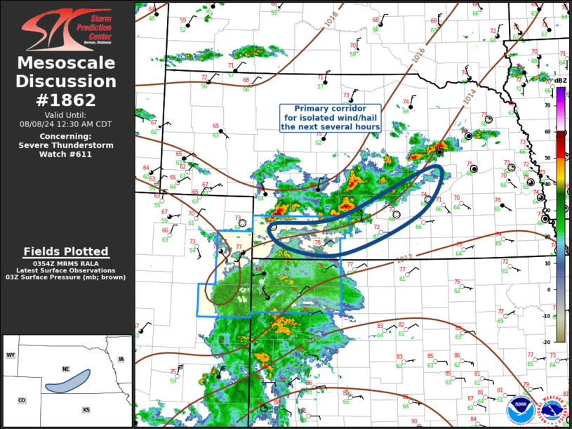
   Areas affected...Southern Nebraska

   Concerning...Severe Thunderstorm Watch 611...

   Valid 080357Z - 080530Z

   The severe weather threat for Severe Thunderstorm Watch 611
   continues.

   SUMMARY...Gusty winds and some hail threat remain possible with
   convection across southern Nebraska the next several hours. New ww
   is not anticipated.

   DISCUSSION...Scattered strong/severe thunderstorms have congregated
   along a frontal zone that is advancing south across the central
   Plains this evening. The primary corridor of convection extends from
   Boone County-northeast of IML, coincident with the wind shift. This
   activity has likely peaked in intensity as it is currently
   propagating through a prefrontal instability axis that will be
   overturned within a few hours, especially with continued
   boundary-layer cooling. Convection across northwestern KS should
   negatively affect these storms as they move south. In the absence of
   further destabilization, the prospect for organized severe is
   expected to gradually wane.

   ..Darrow.. 08/08/2024

   ...Please see www.spc.noaa.gov for graphic product...

   ATTN...WFO...OAX...GID...LBF...GLD...

   LAT...LON   40560165 40670025 41509815 40779842 40100010 40190133
               40560165
|
|
Top/All Mesoscale Discussions/Forecast Products/Home
|
|


