|
| Mesoscale Discussion 1852 |
|
< Previous MD Next MD >
|

|
   Mesoscale Discussion 1852
   NWS Storm Prediction Center Norman OK
   0833 PM CDT Tue Aug 06 2024

   Areas affected...southeastern Montana...northeastern
   Wyoming...western South Dakota

   Concerning...Severe Thunderstorm Watch 608...

   Valid 070133Z - 070230Z

   The severe weather threat for Severe Thunderstorm Watch 608
   continues.

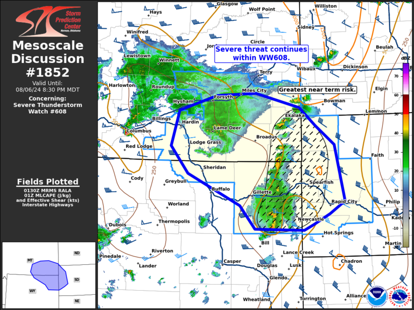
   SUMMARY...Severe threat continues within WW608.

   DISCUSSION...Two clusters of thunderstorms are ongoing across
   portions of southeastern Montana and northeastern Wyoming. Storms
   have produced severe gusts up to 68 mph and hail up to 1 inch in the
   last couple of hours. The greatest near term threat appears to be
   across northeastern Wyoming into western South Dakota. Lightning
   activity with this cluster of storms has been more frequent. With
   eastward extent, these storms will encounter a capped airmass across
   western South Dakota, with MLCAPE 500-1000 J/kg. Enhanced mid-level
   flow across this region is supporting 40-45 kts of deep layer shear,
   which may aid in maintaining organized storms in the near term. The
   00z RAOB from Rapid City shows MLCIN to be generally weak amid steep
   low to mid-level lapse rates. Potential for strong to severe winds
   and large hail will continue across Wyoming into western South
   Dakota in the near term.

   ..Thornton.. 08/07/2024

   ...Please see www.spc.noaa.gov for graphic product...

   ATTN...WFO...BIS...UNR...BYZ...RIW...

   LAT...LON   45740363 46110409 46410539 46360654 46050765 45310788
               44740737 44070584 43580540 43560398 43670371 43900323
               44150279 45340307 45740363
|
|
Top/All Mesoscale Discussions/Forecast Products/Home
|
|


