|
| Mesoscale Discussion 1841 |
|
< Previous MD Next MD >
|

|
   Mesoscale Discussion 1841
   NWS Storm Prediction Center Norman OK
   0757 AM CDT Tue Aug 06 2024

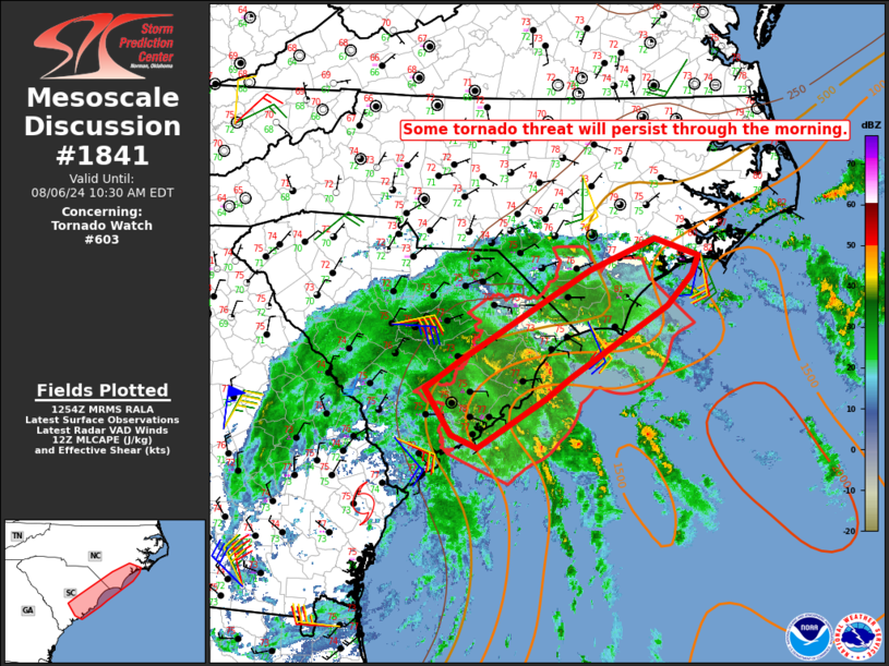
   Areas affected...Parts of coastal SC/NC

   Concerning...Tornado Watch 603...

   Valid 061257Z - 061430Z

   The severe weather threat for Tornado Watch 603 continues.

   SUMMARY...Some tornado threat will persist through the morning.

   DISCUSSION...Early visible satellite imagery depicts widespread
   cloudiness across coastal SC/NC, which will tend to inhibit
   destabilization through the morning. However, dewpoints in the
   mid/upper 70s F across near-coastal areas will continue to support
   MLCAPE of around 500 J/kg (as noted on the 12Z MHX sounding). This
   will be sufficient for maintenance of at least transient small
   supercell structures, given the presence of 0-1 km SRH of 150-250
   m2/s2 in the northeast quadrant of Tropical Storm Debby.

   The stronger wind field will gradually spread northeastward through
   the day, and some tornado threat may eventually spread out of WW 603
   into a larger part of eastern NC, where somewhat stronger heating
   may occur through the morning. Eventual watch issuance north of WW
   603 is possible if observational trends warrant.

   ..Dean/Edwards.. 08/06/2024

   ...Please see www.spc.noaa.gov for graphic product...

   ATTN...WFO...MHX...RAH...ILM...CHS...CAE...

   LAT...LON   33107899 32537993 32698028 33218065 33558015 34577838
               34947749 34747690 34527698 34177733 33347866 33107899
|
|
Top/All Mesoscale Discussions/Forecast Products/Home
|
|


