|
| Mesoscale Discussion 1832 |
|
< Previous MD Next MD >
|

|
   Mesoscale Discussion 1832
   NWS Storm Prediction Center Norman OK
   0711 PM CDT Mon Aug 05 2024

   Areas affected...parts of southeastern Georgia and adjacent
   southeastern South Carolina

   Concerning...Tornado Watch 599...

   Valid 060011Z - 060215Z

   The severe weather threat for Tornado Watch 599 continues.

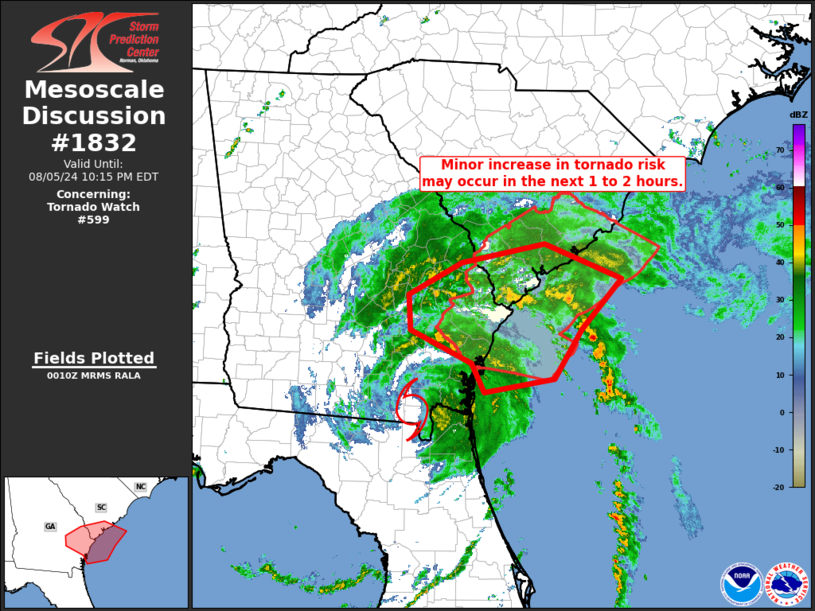
   SUMMARY...Tornado threat may increase a bit over the next couple of
   hours, northeast of the center of T. S. Debby.

   DISCUSSION...Latest radar loop shows the center of Debby drifting
   slowly northeastward, now across the Georgia/Florida state line.
   Northeast of the center of circulation, offshore east of the mouth
   of the Savannah River, some increase in low-level circulations
   associated with cellular convection has been noted over the past
   hour.  While these circulations have continued to weaken as cells
   approach the coast, and to this point none have moved onshore, there
   appears to be a slightly greater chance that this occurs -- which
   could pose risk for a brief tornado(es).  Greatest risk in the short
   term would appear to be over coastal/far southeastern South Carolina
   (coastal portions of Jasper/Beaufort/Charleston/Colleton Counties)
   in South Carolina.

   ..Goss.. 08/06/2024

   ...Please see www.spc.noaa.gov for graphic product...

   ATTN...WFO...CHS...JAX...FFC...

   LAT...LON   30968125 31338145 31768235 32208238 32618159 32858036
               32417920 31767981 31138021 30968125
|
|
Top/All Mesoscale Discussions/Forecast Products/Home
|
|


