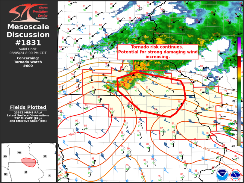
|
| Mesoscale Discussion 1831 |
|
< Previous MD Next MD >
|

|
   Mesoscale Discussion 1831
   NWS Storm Prediction Center Norman OK
   0659 PM CDT Mon Aug 05 2024

   Areas affected...southern Minnesota

   Concerning...Tornado Watch 600...

   Valid 052359Z - 060100Z

   The severe weather threat for Tornado Watch 600 continues.

   SUMMARY...Tornado risk continues within WW600. Localized damaging
   wind threat may increase in the next hour.

   DISCUSSION...A cluster of supercells is currently moving
   southeastward across portions of southern MN. These cells have a
   history of producing tornadoes and large hail (up to 1.5 inches in
   diameter). The risk for tornadoes will continue in the short term
   with these cells, with MPX VAD indicating 0-3 km SRH 430 m2/s2.
   These cells are also producing very heavy precipitation, with the
   potential for evaporative cooling and strong outflow winds
   increasing as cells evolve into a more linear mode. Isolated
   damaging gusts 65-80 mph are possible.

   ..Thornton.. 08/05/2024

   ...Please see www.spc.noaa.gov for graphic product...

   ATTN...WFO...ARX...MPX...DMX...

   LAT...LON   44159340 43969414 43639410 43089325 42959244 42929213
               43019192 43209171 43419155 43749161 43919173 44159340
|
|
Top/All Mesoscale Discussions/Forecast Products/Home
|
|


