|
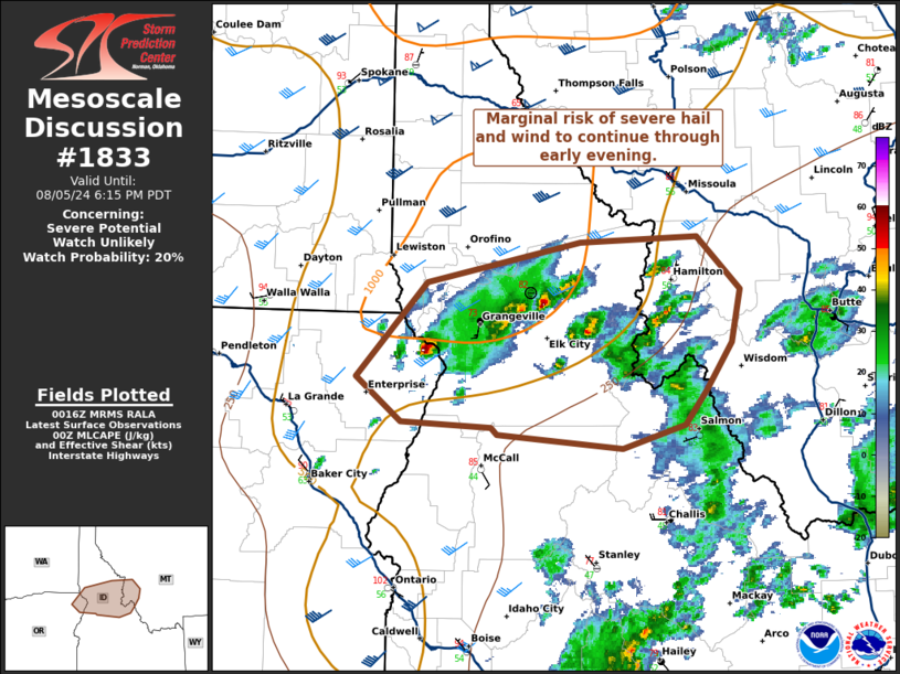
| Mesoscale Discussion 1833 |
|
< Previous MD Next MD >
|

|
   Mesoscale Discussion 1833
   NWS Storm Prediction Center Norman OK
   0718 PM CDT Mon Aug 05 2024

   Areas affected...northern Idaho...far northeast Oregon...far western
   Montana

   Concerning...Severe potential...Watch unlikely

   Valid 060018Z - 060115Z

   Probability of Watch Issuance...20 percent

   SUMMARY...Marginal risk of severe hail and wind.

   DISCUSSION...Cells ongoing across portions of northern Idaho will
   have potential to produce instances of large hail and damaging wind.
   A few reports of hail 0.75-1 inch have been reported in the last
   hour. More discrete cells will continue to pose risk of large hail,
   given MLCAPE 500-1000 J/kg and deep layer shear around 50 kts.
   Clusters and linear segments will pose potential for damaging wind,
   given deeply mixed profiles and steep low to mid-level lapse rates
   around 8-9 C/km. Overall, this threat will remain too localized for
   watch issuance.

   ..Thornton/Smith.. 08/06/2024

   ...Please see www.spc.noaa.gov for graphic product...

   ATTN...WFO...TFX...MSO...BOI...OTX...PDT...

   LAT...LON   46221665 45531737 45211691 45171600 45121593 45021466
               45201402 45441379 45791354 46161344 46551388 46501509
               46221665
|
|
Top/All Mesoscale Discussions/Forecast Products/Home
|
|


