|
| Mesoscale Discussion 1820 |
|
< Previous MD Next MD >
|

|
   Mesoscale Discussion 1820
   NWS Storm Prediction Center Norman OK
   1131 PM CDT Sun Aug 04 2024

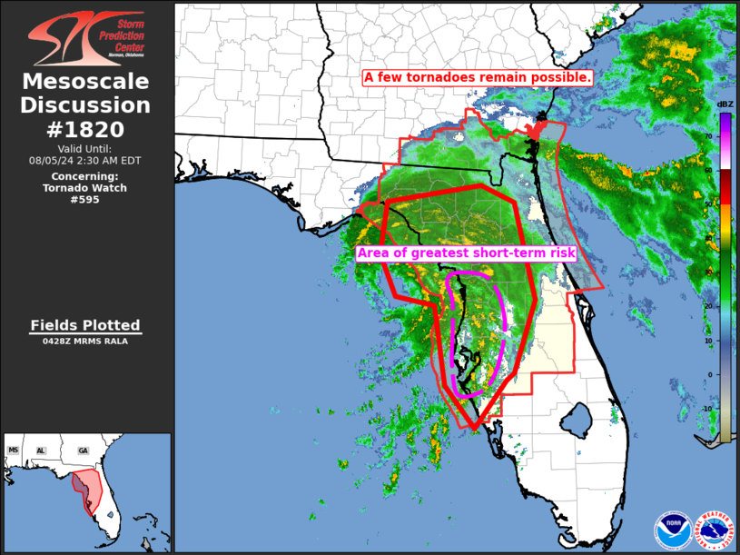
   Areas affected...parts of central and northern Florida

   Concerning...Tornado Watch 595...

   Valid 050431Z - 050630Z

   The severe weather threat for Tornado Watch 595 continues.

   SUMMARY...Risk for a couple of tornadoes continues.

   DISCUSSION...Latest radar loop shows some wobble of the center of
   Hurricane Debby over the past 1 to 2 hours, though it appears that a
   gradual northward advance has commenced recently.  Otherwise, the
   strongest convective bands remain centered across west-central
   Florida, as has been the case for several hours.  Little change in
   the intensity of the bands is noted, though some decrease in the
   number of rotating cells has occurred.  Still, with the low-level
   wind field more than sufficient to support rotating cells,
   occasional/brief tornadic spin-ups remain likely over the next
   several hours.

   ..Goss.. 08/05/2024

   ...Please see www.spc.noaa.gov for graphic product...

   ATTN...WFO...MLB...TBW...JAX...TAE...

   LAT...LON   28748378 29368403 30128393 30368236 30108182 29218160
               28698149 27648183 27548197 26848248 27478297 28628313
               28748378
|
|
Top/All Mesoscale Discussions/Forecast Products/Home
|
|


