|
| Mesoscale Discussion 1821 |
|
< Previous MD Next MD >
|

|
   Mesoscale Discussion 1821
   NWS Storm Prediction Center Norman OK
   0409 AM CDT Mon Aug 05 2024

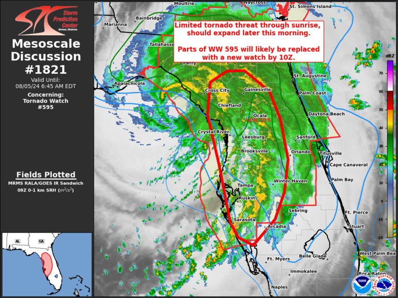
   Areas affected...west-central to north FL

   Concerning...Tornado Watch 595...

   Valid 050909Z - 051045Z

   The severe weather threat for Tornado Watch 595 continues.

   SUMMARY...Threat for a couple tornadoes should primarily be confined
   to the west-central Florida Peninsula through sunrise, but should
   increase later this morning across parts of central and north
   Florida. Replacement of WW 595 is expected before its 10Z
   expiration.

   DISCUSSION...Transient rotation within outer-band thunderstorms has
   largely been confined to the west-central FL Peninsula over the past
   several hours. This near-term threat is roughly centered from
   Sarasota to western Lake counties, largely south through northeast
   of Tampa Bay. The 06Z TBW sounding sampled a favorable environment
   for a couple tornadoes, characterized by MLCAPE near 1000 J/kg amid
   0-1 km SRH of 150-200 m2/s2.

   As limited diabatic surface heating occurs after sunrise beneath the
   extensive cloud canopy surrounding slow-moving Debby, a gradual
   boost to MLCAPE should occur farther north and inland. Recent CAM
   guidance suggests potential for intermediate banded structures to
   reform north of the Tampa Bay area as this occurs, which would yield
   a larger spatial extent of the tornado threat. The east-central/
   northeast coast of the peninsula will likely have a near-term nil
   threat owing to meager MLCAPE of about 250 J/kg per the 06Z JAX/XMR
   soundings, and may struggle to appreciably increase until late
   morning if an outer band can separately form off the east coast and
   spread inland. CAM guidance suggests this may tend to focus from the
   FL/GA border northward later this morning.

   ..Grams/Edwards.. 08/05/2024

   ...Please see www.spc.noaa.gov for graphic product...

   ATTN...WFO...MLB...TBW...JAX...TAE...

   LAT...LON   29268304 29848299 30038265 30048230 29688178 29188156
               28458142 27888150 27398168 26948211 27088242 27348258
               28388281 29268304
|
|
Top/All Mesoscale Discussions/Forecast Products/Home
|
|


