|
| Mesoscale Discussion 1819 |
|
< Previous MD Next MD >
|

|
   Mesoscale Discussion 1819
   NWS Storm Prediction Center Norman OK
   0911 PM CDT Sun Aug 04 2024

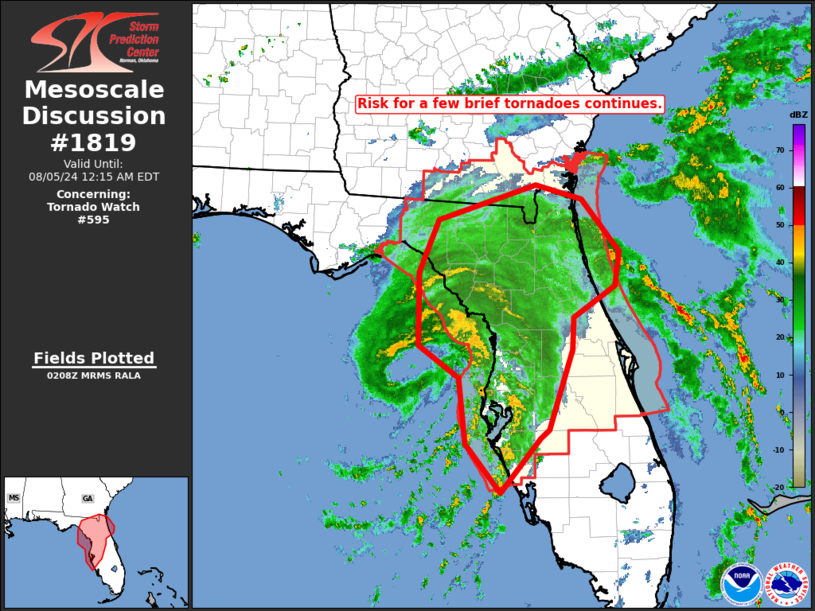
   Areas affected...central and northern Florida and into far southern
   Georgia

   Concerning...Tornado Watch 595...

   Valid 050211Z - 050415Z

   The severe weather threat for Tornado Watch 595 continues.

   SUMMARY...Tornado risk continues across portions of northern and
   central Florida and may extend into far southern Georgia in the next
   couple of hours, within stronger convective bands surrounding Debby.

   DISCUSSION...Latest radar loop shows that Debby has continued making
   slow, generally northward progress over the past couple of hours,
   with the strongest convective bands now near the west-central
   Florida Gulf coast.  While an earlier tornado was reported in
   north-central Florida (Union County), observed/rotating cells are
   currently confined primarily to within a couple of strong convective
   bands within a zone from southwest of KVNC (Venice, FL) northward
   across the Tampa Area, and then northward to near and northwest of
   KCNC (Crystal River Airport, FL).  However, lesser risk remains
   possible over a broader area east of Debby's center.

   ..Goss.. 08/05/2024

   ...Please see www.spc.noaa.gov for graphic product...

   ATTN...WFO...MLB...TBW...JAX...TAE...

   LAT...LON   28748378 29718378 30408349 30868202 30678134 29978077
               29528085 29128146 28698149 27648183 27548197 26838256
               27468307 28328318 28748378
|
|
Top/All Mesoscale Discussions/Forecast Products/Home
|
|


