|
| Mesoscale Discussion 1789 |
|
< Previous MD Next MD >
|

|
   Mesoscale Discussion 1789
   NWS Storm Prediction Center Norman OK
   0251 PM CDT Thu Aug 01 2024

   Areas affected...southern Indiana into central KY

   Concerning...Severe Thunderstorm Watch 588...

   Valid 011951Z - 012115Z

   The severe weather threat for Severe Thunderstorm Watch 588
   continues.

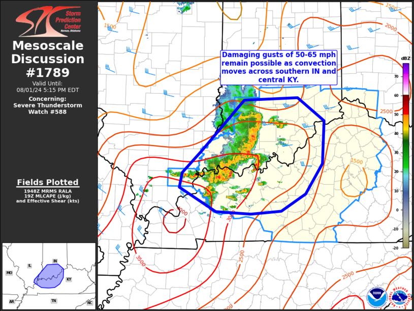
   SUMMARY...Damaging gusts of 50-65 mph remain possible across
   southern Indiana into central Kentucky this afternoon.

   DISCUSSION...An organized bow will continue to track east across
   Kentuckiana this afternoon. While the intensity of the bow has
   decreased somewhat compared to earlier, the VWP from KVWX shows rear
   inflow around 40-50 kt. Additional discrete cells have also
   developed ahead of the bow. Re-intensification of the bow may occur
   as storm mergers/interactions occur, and damaging gust potential may
   increase over the next hour or so. The downstream airmass remains
   very warm/moist, with a corridor of MCLAPE around 2000-2500 J/kg
   noted in 19z mesoanalysis. Vertical shear remains somewhat modest
   and may be limiting factor in producing a more widespread damaging
   wind swath. Nevertheless, isolated to widely scattered gusts in the
   50-65 mph range appear likely over the next few hours.

   ..Leitman/Bunting.. 08/01/2024

   ...Please see www.spc.noaa.gov for graphic product...

   ATTN...WFO...ILN...LMK...IND...PAH...

   LAT...LON   39128701 39168582 38748523 38008528 37478566 37168620
               37118687 37168764 37578844 37838838 38238795 39128701
|
|
Top/All Mesoscale Discussions/Forecast Products/Home
|
|


