|
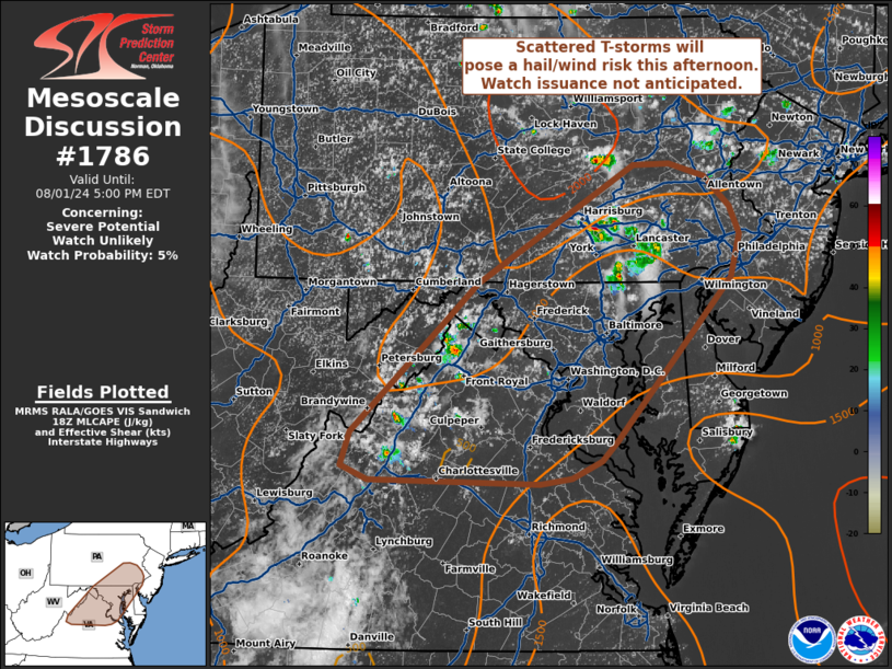
| Mesoscale Discussion 1786 |
|
< Previous MD Next MD >
|

|
   Mesoscale Discussion 1786
   NWS Storm Prediction Center Norman OK
   0153 PM CDT Thu Aug 01 2024

   Areas affected...Portions of the Mid-Atlantic

   Concerning...Severe potential...Watch unlikely

   Valid 011853Z - 012100Z

   Probability of Watch Issuance...5 percent

   SUMMARY...Developing thunderstorms may pose an isolated damaging
   wind threat this afternoon and early evening. Limited environmental
   wind shear will modulate the overall severe threat and preclude the
   need for a watch.

   DISCUSSION...Convection has been slow to mature across the
   Mid-Atlantic region over the past few hours - largely due to modest
   (around 5.5 C/km) mid-level lapse rates and shallow EL levels.
   Nonetheless, continued daytime heating has been promoting gradual
   destabilization and a slow uptick in convective intensity based on
   recent GOES IR imagery and lightning trends over the past 30 minutes
   or so. Continued daytime heating may act to mix out the seasonally
   marginal low-level moisture downstream of developing convection,
   which should limit MLCAPE to around 1000 J/kg. However, this will
   maximize boundary-layer mixing/depth and support steep low-level
   lapse rates favorable for downdraft acceleration. Weak flow over the
   region will generally limit storm longevity and organization, but
   sporadic damaging winds (generally between 40-60 mph) appear
   possible given the thermodynamic environment.

   ..Moore/Gleason.. 08/01/2024

   ...Please see www.spc.noaa.gov for graphic product...

   ATTN...WFO...PHI...AKQ...CTP...LWX...RNK...

   LAT...LON   38137953 38417943 39707803 40737630 40747590 40627550
               40377522 40127511 39757522 38357648 38177666 38027698
               37987734 38007923 38137953
|
|
Top/All Mesoscale Discussions/Forecast Products/Home
|
|


