|
| Mesoscale Discussion 1777 |
|
< Previous MD Next MD >
|

|
   Mesoscale Discussion 1777
   NWS Storm Prediction Center Norman OK
   0700 PM CDT Wed Jul 31 2024

   Areas affected...Portions of central Kansas

   Concerning...Severe Thunderstorm Watch 583...

   Valid 010000Z - 010100Z

   The severe weather threat for Severe Thunderstorm Watch 583
   continues.

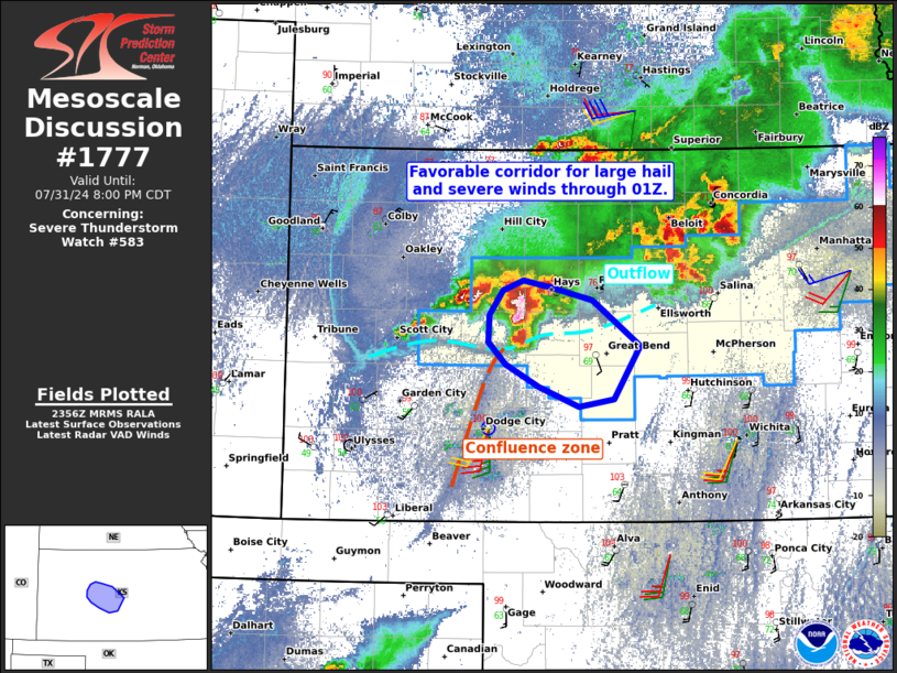
   SUMMARY...The severe threat continues across Severe Thunderstorm
   Watch 583, with a focused favorable corridor for large hail and
   severe winds over parts of central KS.

   DISCUSSION...Latest radar data from DDC shows an intense
   semi-discrete supercell southwest of Hays, KS -- at the intersection
   of an outflow boundary and north/south-oriented confluence zone.
   This focused area of mesoscale ascent should support the maintenance
   of this supercell for another hour or so as it tracks along the
   boundary. Around 30 kt of effective shear oriented parallel to the
   boundary may support some localized upscale growth, while moderate
   surface-based instability favors continued intensity. Large hail (up
   to around 2 inches) and severe gusts to around 75 mph are the
   primary concerns.

   ..Weinman.. 08/01/2024

   ...Please see www.spc.noaa.gov for graphic product...

   ATTN...WFO...ICT...DDC...

   LAT...LON   38459997 38679996 38879981 38949960 38899931 38789889
               38419840 37989868 37939904 38099945 38279978 38459997
|
|
Top/All Mesoscale Discussions/Forecast Products/Home
|
|


