|
| Mesoscale Discussion 1778 |
|
< Previous MD Next MD >
|

|
   Mesoscale Discussion 1778
   NWS Storm Prediction Center Norman OK
   0842 PM CDT Wed Jul 31 2024

   Areas affected...Portions of southern and central Iowa into far
   north-central Missouri

   Concerning...Severe Thunderstorm Watch 584...

   Valid 010142Z - 010315Z

   The severe weather threat for Severe Thunderstorm Watch 584
   continues.

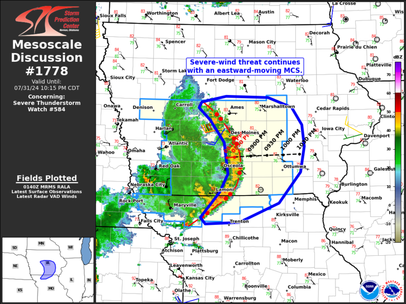
   SUMMARY...The severe-wind risk continues with an eastward-moving MCS
   across portions of central and southern Iowa into far north-central
   Missouri.

   DISCUSSION...Latest radar data from KDMX shows a bowing MCS tracking
   eastward at 35 kt across parts of central/southern IA and
   north-central MO as of 0140Z. This MCS has been producing 60-70 mph
   wind gusts. Very moist east-southeasterly inflow (middle/upper 70s
   dewpoints) and around 35 kt of gust-front-orthogonal effective shear
   should support the maintenance of this MCS as it continues eastward
   across Severe Thunderstorm Watch 584. The primary concern is severe
   gusts upwards of 65-75 mph.

   Downstream of the watch, inhibition gradually increases with
   eastward extent per earlier visible satellite imagery, surface
   observations, and the DVN 00Z observed sounding. This may yield an
   eventual decrease in intensity/organization, though convective
   trends will be monitored.

   ..Weinman.. 08/01/2024

   ...Please see www.spc.noaa.gov for graphic product...

   ATTN...WFO...DVN...DMX...EAX...

   LAT...LON   41879405 42079431 42179425 42289368 42259273 42099219
               41789196 41419191 40979199 40449249 40119337 40099414
               40199425 40649381 40959364 41489372 41879405
|
|
Top/All Mesoscale Discussions/Forecast Products/Home
|
|


