|
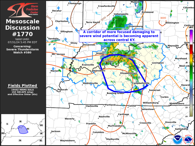
| Mesoscale Discussion 1770 |
|
< Previous MD Next MD >
|

|
   Mesoscale Discussion 1770
   NWS Storm Prediction Center Norman OK
   0247 PM CDT Wed Jul 31 2024

   Areas affected...far southern Indiana into central Kentucky

   Concerning...Severe Thunderstorm Watch 580...

   Valid 311947Z - 312145Z

   The severe weather threat for Severe Thunderstorm Watch 580
   continues.

   SUMMARY...The damaging/severe wind threat should remain focused
   across southern Indiana into central Kentucky for the next few hours
   as a consolidated cold pool becomes established.

   DISCUSSION...A consolidating cold pool is becoming evident in recent
   KLVX velocity imagery roughly along the OH River. This may be the
   start of a somewhat more organized MCS that will pose a relatively
   focused wind threat to areas downstream - namely central KY. To the
   southeast of the developing MCS, a more broken,
   meridionally-oriented, line of disorganized convection is
   delineating the western edge of a residual cold pool from prior
   convection where temperatures remain in the 70s and stable billow
   clouds are noted in visible imagery. As such, the developing MCS
   will likely continue to propagate south/southeast where buoyancy
   remains very favorable for convective maintenance (MLCAPE values in
   the 2000-3000 J/kg range). Limited line-orthogonal deep-layer wind
   shear may be a modulating factor to overall convective intensity
   given west/northwest deep-layer wind shear vectors, but the
   high-CAPE environment and surging cold pool should continue to
   support a damaging/severe wind threat for the next few hours.

   ..Moore.. 07/31/2024

   ...Please see www.spc.noaa.gov for graphic product...

   ATTN...WFO...LMK...

   LAT...LON   38058673 38258662 38388630 38408588 38338555 38208528
               37318465 37218483 37138507 37078544 37078574 37108610
               37218636 38058673
|
|
Top/All Mesoscale Discussions/Forecast Products/Home
|
|


